Apsan Observatory: Daegu from the mountainside
Thorfinn Stainforth · Original · CC BY-SA 3.0 ·
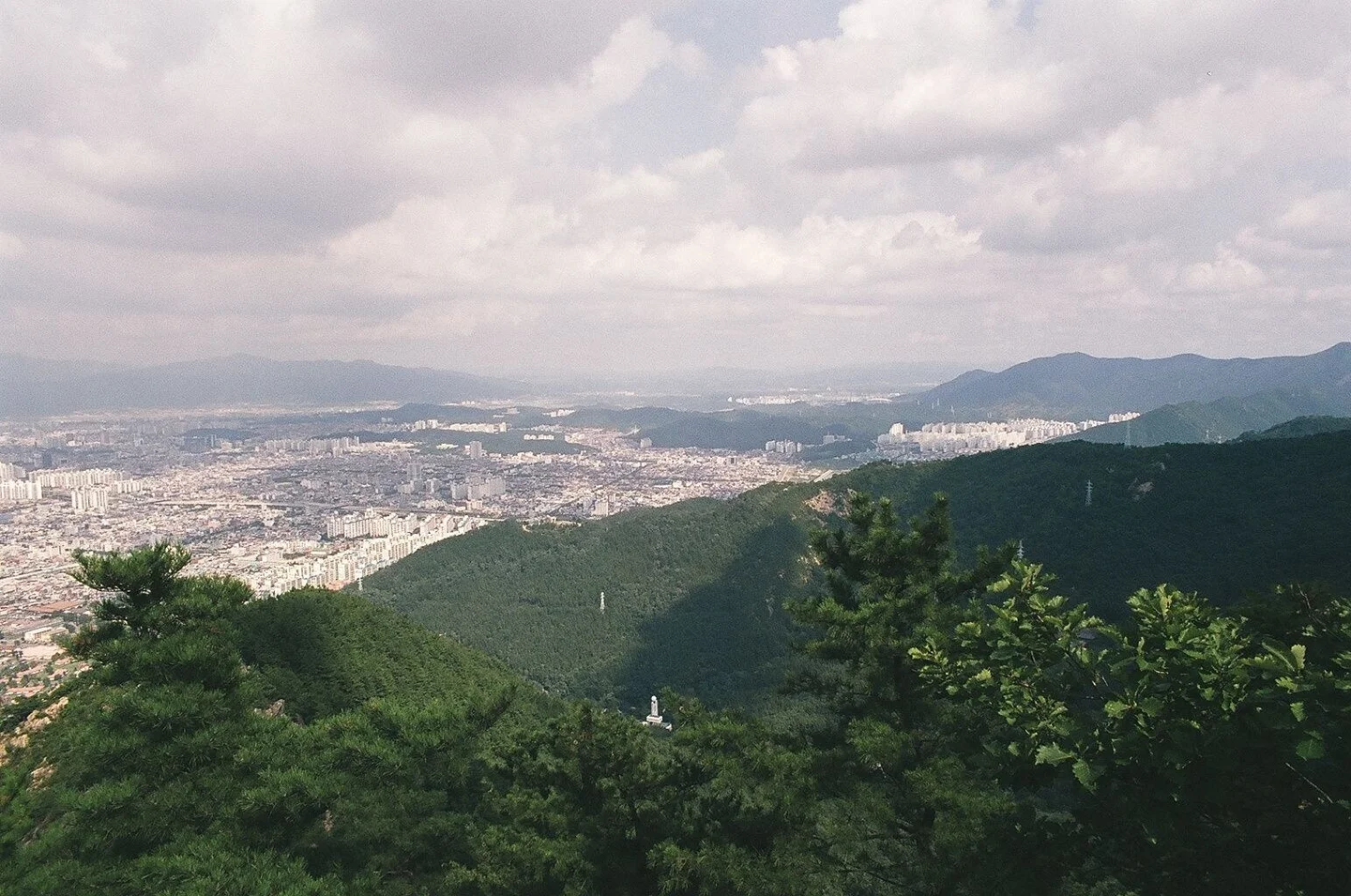
Daegu makes more sense from Apsan. The streets spread out below the mountain, apartment blocks mark the newer neighborhoods, and ridges close the horizon around the city. From the observatory’s open deck, you get a sense of the basin that a walk through downtown cannot give you. It is especially rewarding toward evening, when there is still enough light to see the mountains and the first lines of traffic begin to glow. You have two main ways up: a cable car from Keungol, or a hike through Anjiranggol past Anilsa Temple. Choose the cable car if the view is the main event. Choose the hiking route if you want the forest and climb to be part of the outing. Their starting points are different, so decide which route you are using before setting a taxi destination or public-transit directions. One map-search detail matters here. Apsan Observatory is the mountain viewpoint. Apsan Sunset Observatory, also called Haeneomi Observatory, is a separate tower in Apsan Laundry Park down by the neighborhood. Both offer views, but they are different destinations with different approaches.
The cable-car route still involves some walking
For the lift, search for Apsan Cable Car and approach through Keungol in Apsan Park. Daegu’s tourism guide describes an uphill walk of about 15 minutes through this valley to the lower station. Add that approach to your arrival time, along with ticketing and any queue. The observatory also requires a walk from the upper station, so the cable car reduces the climb without providing door-to-deck access. The operator gives a ride time of about five minutes. As checked on October 12, 2026, an adult round trip costs 14,000 won and a one-way ticket 10,000 won. A round trip is the simplest choice for a sightseeing visit. If you plan to hike one way, work out the trail and onward transport before buying: walking down to Anjiranggol leaves you in a different place from the cable-car departure point. Wheelchair users need a different plan. The Korea Tourism Organization’s accessibility information, updated in September 2026, explicitly lists wheelchair boarding as unavailable on this cable car. Discuss your particular access needs with the operator before traveling. The separate Sunset Observatory in Laundry Park is listed by Nam-gu as wheelchair-accessible, with a ramp to its lower-level city viewpoint; it can be worth considering when mountain access is unsuitable.
What to look for in the daytime view
The strongest impression is the abrupt meeting of forest and city. Dark slopes run down toward tightly packed streets, while larger buildings stand out beyond them. Look across the whole panorama first, then use a map to find the districts you have visited. After a day around Dongseongno or the western side of downtown, tracing those places from above gives the view a personal connection. The deck’s transparent railing helps keep the foreground open. You can linger over the small patterns: long straight roads, pockets of green, repeated rows of apartments, and mountains appearing through gaps in the skyline. This is a worthwhile daytime stop in its own right, particularly if you prefer to return to the city before dark. Choose your day with visibility in mind. A forecast with no rain can still mean haze over the basin, so check air quality as well as cloud cover if distant views are your priority. Apsan has additional trails and viewpoints, but reaching this deck does not mean you have completed a summit hike. Allow separate time and preparation if you want to continue onto the ridges.
Planning for sunset and the lights
Im Taewon · Original · KOGL Type 1 ·
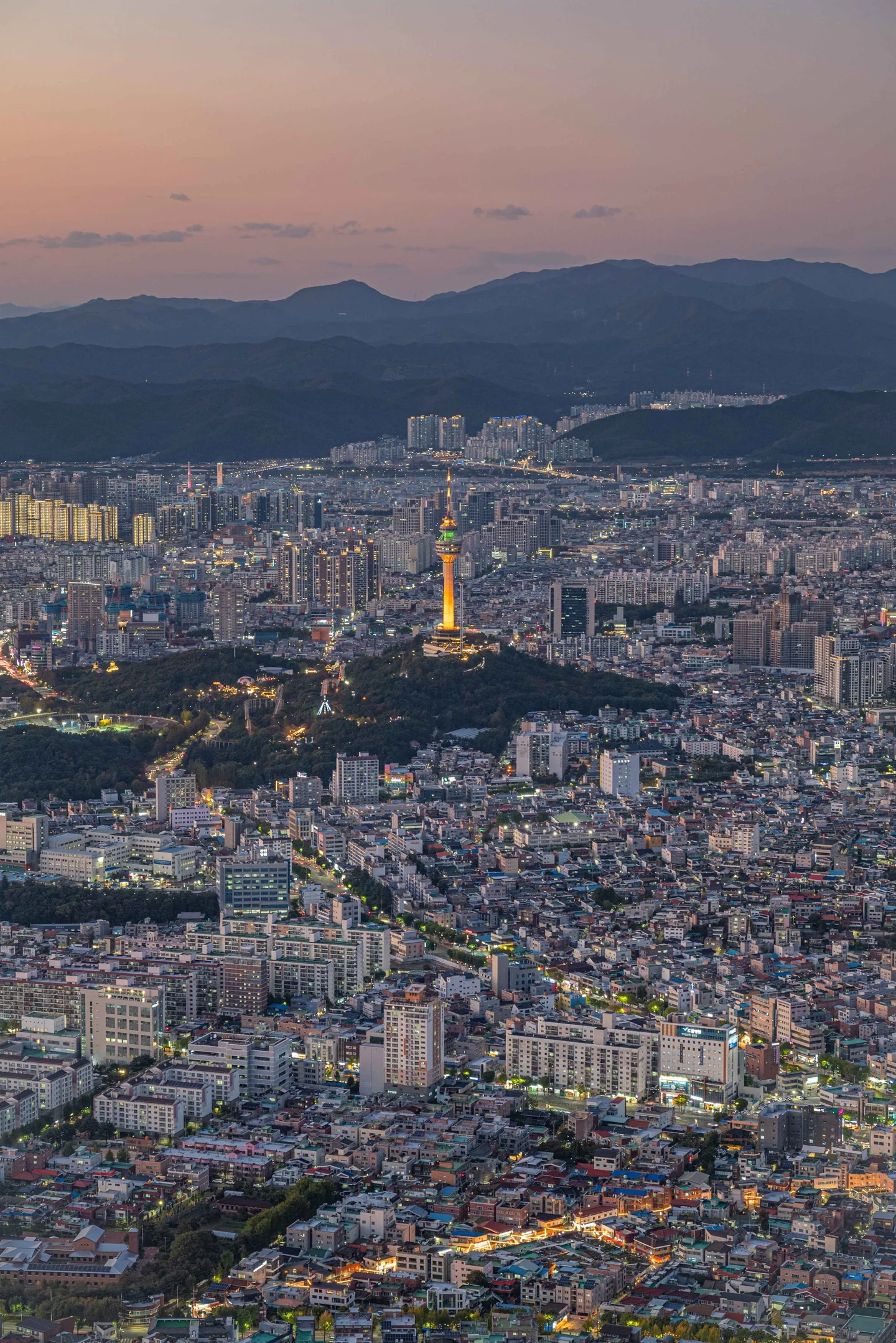
Try to reach the viewpoint while the city is still visible in daylight. As the light fades, the mountains become silhouettes and the roads take over as the clearest lines in the scene. The illuminated 83 Tower is a useful landmark among the neighborhoods below. Staying through that transition gives you more variety than arriving only after the sky has gone black. The cable car’s final departure changes by month and day of the week. Its October schedule, checked on October 12, 2026, gives the last downhill car at 7 p.m. Monday–Thursday and 9 p.m. Friday–Sunday and public holidays. Ticket sales end at least 30 minutes before the final departure. Other months have different closing times, and weather or maintenance may shorten operations, so use the operator’s current monthly table when choosing your visit. Leave time to walk back from the deck to the upper station. If the day’s timetable does not allow the evening you had in mind, choose a daylight visit rather than depending on an unfamiliar mountain descent after dark. Hikers who specifically want a night route need the equipment and route knowledge for a mountain walk, not just a phone used for city navigation.
Hiking past Anilsa Temple
朴珍秀 · Original · CC BY-SA 4.0 ·
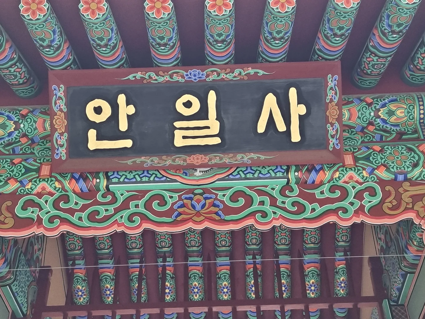
From Anjiranggol, the route passes Anilsa Temple before continuing up to the observatory. Nam-gu lists this approach as about 2.5 kilometers, roughly 1½ miles, taking around an hour one way. Treat that as a walking estimate: your climb, rests, time at the viewpoint, and descent all belong in the schedule. It is a hike with sustained uphill sections, even though the trail begins close to residential streets. Anilsa provides a distinct stopping point on the climb. Its colorful painted eaves and gold Korean nameboard contrast with the forest around it. Local tradition connects the temple and nearby caves with Wang Geon, founder of the Goryeo dynasty, who is said to have taken refuge in the Apsan area after defeat in battle. The refuge stories are part of the mountain’s local identity, and are best understood as traditions associated with the sites. Pause in the temple’s open visitor areas without interrupting worship, then decide whether to continue upward or turn back. For a first visit, a daylight out-and-back walk keeps the route easy to follow and brings you back to the same neighborhood. Wear shoes with good traction and allow more time after rain, when the uphill path and steps can be slippery.
A meal at the foot of the mountain
If you descend toward Anjiranggol, Anjirang Gopchang Alley is a fitting dinner stop. Its restaurants specialize in grilled offal, especially gopchang and makchang, so this is a place to try a distinctive Daegu meal if those ingredients appeal to you. The food street developed around Anjirang Market on the road toward the valley, which makes it a more natural pairing with that hiking approach than with the separate cable-car station. For coffee or a broader choice of meals, look around Apsan Café Street near Nammyeong Junction, where Daemyeongnam-ro and Hyeonchung-ro meet. Nam-gu’s guide describes cafés alongside Italian and Japanese-style restaurants, with the mountain as the backdrop. Select the actual café or restaurant on your map and route there from your chosen descent point. That small decision saves unnecessary backtracking around the foot of Apsan.
A separate stop in Gosangol
For a different look at Apsan's lower slopes, plan Gosangol as its own stop. Beopjangsa's three-story stone pagoda rises above a broad base, with three roof stones stacked between the temple's tiled roofs. This April 2023 photograph shows Beopjangsa, not Anilsa or the observatory deck.
At Gosangol Dinosaur Park, look beyond the models to the fossil-bearing rock. Ripple-like textures and shallow contours offer a close-up contrast to the city panorama. The rock photograph dates to January 2023. Gosangol is a different approach from Keungol and Anjiranggol, not an assumed short cut from the observatory; check open routes and allow separate travel time.