Eonyang and the Yeongnam Alps: choose a mountain day or a heritage walk
Ronnie Dayo · Original · CC BY-SA 3.0 ·
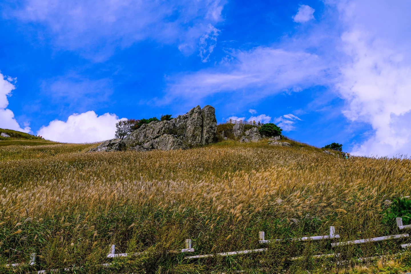
West of Ulsan’s coast, Eonyang opens onto a landscape of high ridges, broad grassy saddles, and wooded temple slopes. The Yeongnam Alps are especially appealing when autumn light catches the silver-grass fields around Ganwoljae. Yet you can also stay below the peaks, exploring a town fortress, a Buddhist temple, or the rock-carving sites along Bangucheon Stream. The name covers a mountain region with several peaks and trailheads, not one attraction with a single entrance. For a day trip, choose either a substantial hike or a lower-level cultural itinerary. Combining Ganwoljae, a temple, and the petroglyphs into one crowded day leaves little room for the distances between them. Ulsan’s KTX station is a useful arrival point for this western side of the city. From there, specify whether your next destination is central Eonyang, the Yeongnam Alps Welcome Center, or a trailhead near Baenae Pass. Those are different starting points, and your choice determines both the route and the return journey.
Eonyang’s fortress and a local beef lunch
Korea Heritage Service · Original · CC BY-SA 4.0 ·
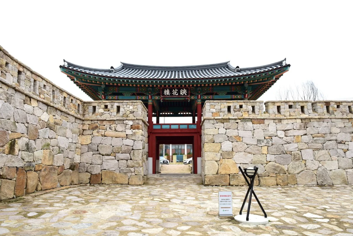
Eonyang Eupseong stands on comparatively level ground in the town, making it an easy historic stop before lunch. Begin at Yeonghwaru, the restored southern gate, then look at the stonework and the relationship between the remaining defenses and the streets around them. The gate’s present appearance comes from restoration, while the fortress itself has a much longer history. This is a place to explore traces of a fortified administrative town within a living community. You will not find an entirely preserved old city enclosed behind the gate. A short visit can focus on the entrance and nearby walls; if you have more time, use the site map to extend the walk through the remaining sections. Eonyang is also known for its style of bulgogi. The city’s food guide describes beef marinated in advance, then grilled on a grate before serving. That makes it a useful local meal to look for, especially if your idea of bulgogi is the broth-based version cooked with vegetables and noodles. Restaurant menus and minimum orders vary, so check the serving size before ordering for a small group. On a non-hiking day, pair the fortress and lunch with one excursion: Seoknamsa for a temple in the foothills, or the petroglyph museum and Bangudae for archaeology and a riverside walk. Public-transport travelers will find that simpler than trying to connect both directions.
Ganwoljae is a hike, even by the gentler approach
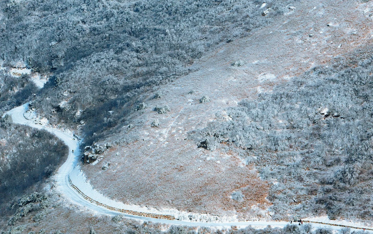
Ganwoljae is the saddle between Ganwolsan and Sinbulsan. Reaching the grassy pass and returning is a complete hiking objective; adding either summit changes the effort and the time required. Decide on that distinction before you set out, rather than extending the route spontaneously after reaching the open ridge. The approach commonly called the deer-farm route starts on the Baenae Pass side and follows a broad forestry road. It is a gentler option than some mountain trails, but it still requires a sustained uphill walk and the journey back. The route from the Welcome Center is different. Save the exact trailhead and planned turnaround point, particularly if a taxi or bus is part of the trip. The Korea Tourism Organization’s route guide identifies Baenae 2 Public Parking Lot as a starting landmark for the deer-farm approach. Use a current trail map to check the full return distance and allow several hours, with extra time for rests and the views. A quoted walking time is only a guide: pace, weather, and seasonal crowding can change it considerably. At the saddle, the trees give way to a more exposed landscape. Silver grass spreads across the slopes, with rocky ridges rising beyond it. Wind can make a rest stop feel much colder than the town below, so carry an appropriate outer layer, water, and food rather than depending entirely on a mountain rest stop. Snow and ice change this outing substantially. A wide road can still become slippery, and an attractive winter landscape is not evidence of easy conditions. Check the mountain forecast and current access notices, allow enough daylight for the return, and choose the lower-level itinerary if you lack the equipment or experience for the conditions. Seasonal fire-prevention restrictions can also affect trail access.
Seoknamsa: temple grounds and a carved stone stupa
작자 미상 · 한국저작권위원회(공유마당) 제공 · Original · Public domain ·
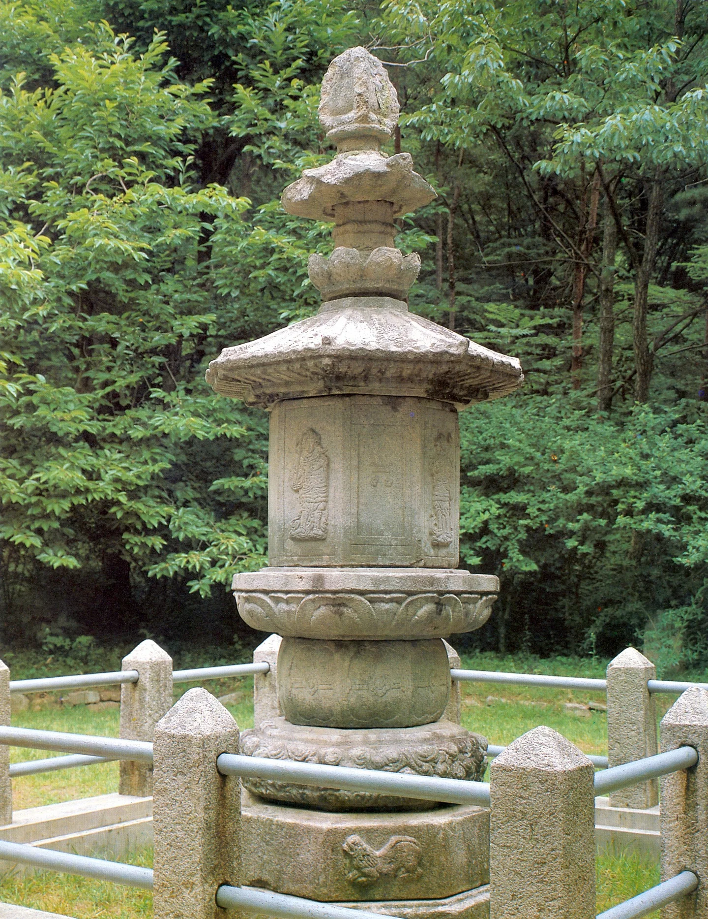
Seoknamsa offers a way to enjoy the mountain setting without committing to a summit. A visit to the temple is a different undertaking from climbing Gajisan, even though hiking routes use the same wider area. Focus on the open temple grounds and the historic stonework, then decide how much of the hillside approach suits your group. The temple’s stupa is a particularly rewarding detail. A stupa holds relics associated with a Buddhist monk; this example has an octagonal body, carved stone supports, and a roof shaped like a small building. Lotus forms, doorway motifs, and guardian figures make the surface worth examining slowly. The Korea Heritage Service’s description identifies it as a fine example of the late Unified Silla tradition. It is traditionally associated with Master Doui, but that identification is not certain. The monument stands on a hill northeast of the main temple, so seeing it involves more than a level circuit of the entrance area. If steps are difficult, check the site plan on arrival and keep to the parts of the precinct that work for you. Seoknamsa remains an active religious community, with visitor access following the spaces currently open around worship and practice.
Bangudae: understand the carvings before seeing the cliff
Korea Heritage Service · Original · CC BY-SA 4.0 ·
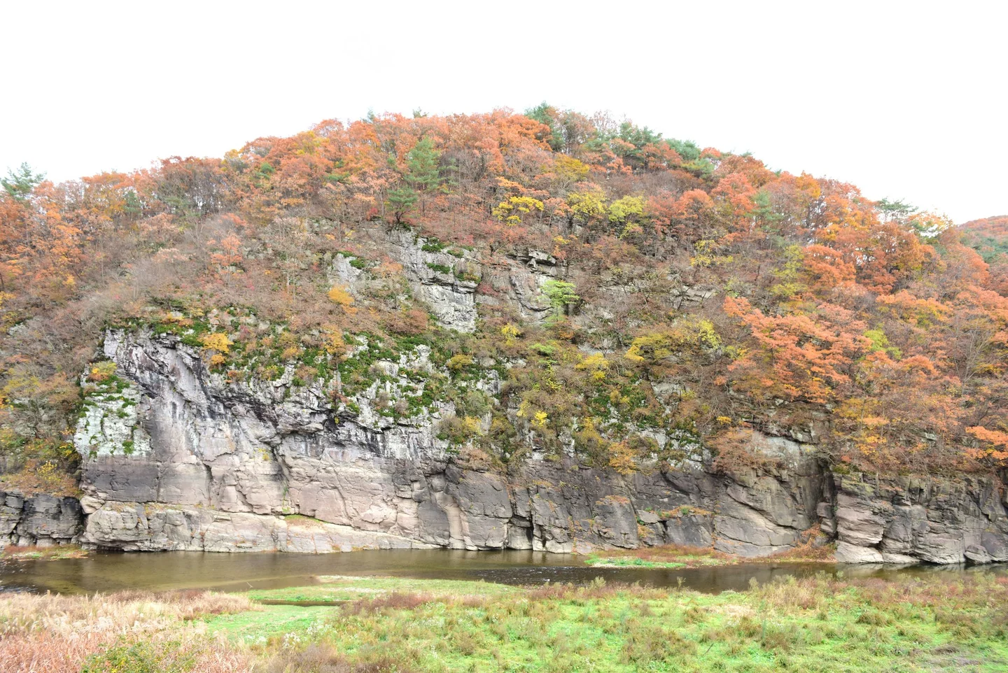
The petroglyphs along Bangucheon Stream offer another distinctive excursion from Eonyang. The two principal rock-carving sites, at Daegok-ri and Cheonjeon-ri, were inscribed on the UNESCO World Heritage List in 2025. Their images and inscriptions span thousands of years, with whales, other animals, human figures, and hunting scenes among the subjects. Start at Ulsan Petroglyph Museum, where replicas and displays make the small engraved forms easier to recognize. Then follow the riverside route toward the Bangudae panel at Daegok-ri. Allow time for the walk in both directions as well as a stop at the viewpoint. Check the museum’s current route map before setting out, since the museum, Bangudae viewing area, and Cheonjeon-ri carvings are separate stops. Bangudae is viewed from across the stream to protect the rock face. Use the viewing equipment and interpretation on site; the fine carvings are not an exhibit you can stand directly beside. Light and water conditions influence visibility, while the surrounding cliffs and stream help explain the setting in which the images were made. Cheonjeon-ri lies in the other direction from the museum and adds a separate walk. Choose one panel if time is short, or devote a longer outing to both. Museum opening hours and any weather-related path restrictions should shape the plan. Keep the mountain hike for another day if you want time to study the replicas and enjoy the streamside routes without rushing.