gil.KOREA

Mudeungsan, Gwangju: Choose a Temple Walk or a Mountain Hike
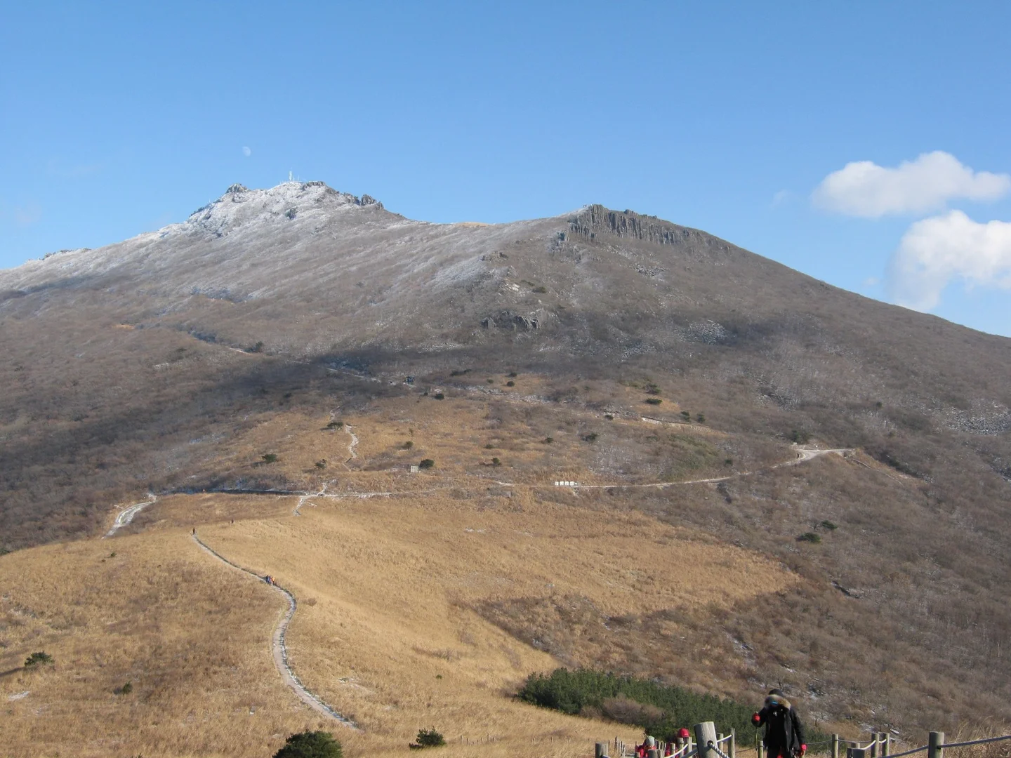
Trail leading to the upper ridge of Mudeungsan Mountain

gary4now · Original · CC BY 3.0 ·

Source notices and processing details

Trail leading to the upper ridge of Mudeungsan Mountain

Photo: gary4now · commons.wikimedia.org — Mt Mudeungsan - panoramio.jpg · CC BY 3.0

WebP conversion; proportionally reduced where needed; no cropping or upscaling.

CC BY 3.0 https://creativecommons.org/licenses/by/3.0 · 저작자 표시 필수

360 × 270: Existing supplied proportional WebP rendition; no new crop, resize, upscaling, distortion or synthesis in this connection batch.

720 × 540: Existing supplied proportional WebP rendition; no new crop, resize, upscaling, distortion or synthesis in this connection batch.

1440 × 1080: Existing supplied proportional WebP rendition; no new crop, resize, upscaling, distortion or synthesis in this connection batch.

Mudeungsan gives Gwangju a mountain backdrop that becomes more varied the farther you walk into it. The lower slopes hold woodland and temples; higher trails open toward the city, grassy ridges, and tall columns of rock. The right visit depends less on reaching a particular summit than on choosing the amount of hiking you want to do. For a half-day that also includes time downtown, Jeungsimsa Temple and the lower forest paths make a practical focus. Jungmeorijae is a more substantial hiking destination. Continuing toward Jangbuljae and the Ipseokdae and Seoseokdae rock formations requires a longer mountain day, with enough time and energy for the descent. Decide which of these outings you want before leaving the city. The Jeungsimsa area is a useful starting point on the Gwangju side. Plan your final bus or taxi connection to the national park entrance area. Hakdong–Jeungsimsa Entrance subway station is not at the temple or the start of the mountain trail; its name should not be taken to mean that the remaining approach is negligible. Download the official trail map and check the Korea National Park Service's current access notices before setting out. Seasonal entry cutoffs, weather restrictions, and closures apply to particular routes. An allowed entry time is not a recommended starting time for every hike: work backward from a realistic return, including breaks and onward transport.

Jeungsimsa as the Destination
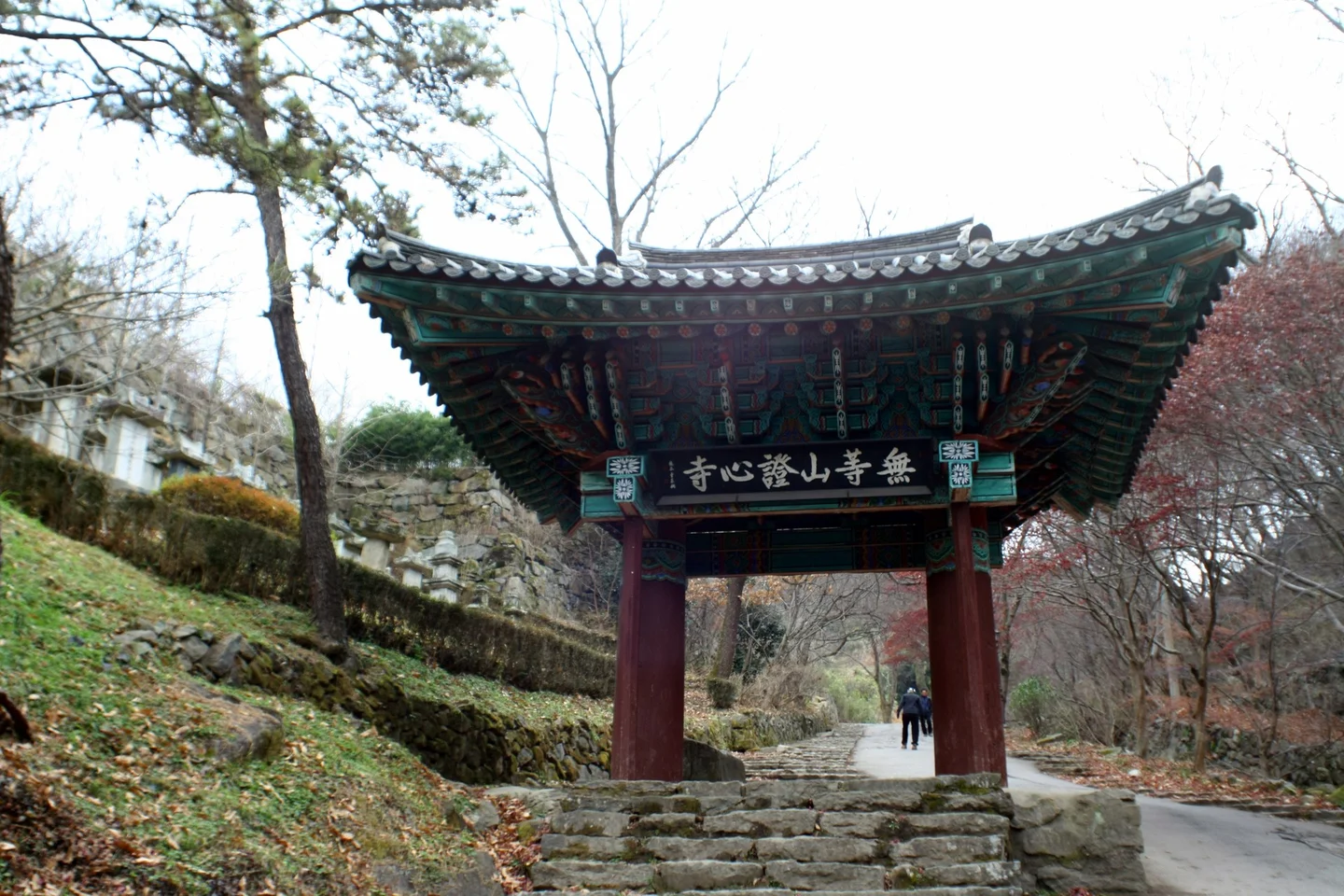
Iljumun Gate of Jeungsimsa Temple located on a forest path

Dalgial · Original · CC BY-SA 3.0 ·

Source notices and processing details

Iljumun Gate of Jeungsimsa Temple located on a forest path

Photo: Dalgial · commons.wikimedia.org — 증심사 일주문.JPG · CC BY-SA 3.0

WebP conversion; proportionally reduced where needed; no cropping or upscaling.

Processed copies are provided under the same license shown above.

CC BY-SA 3.0 https://creativecommons.org/licenses/by-sa/3.0 · 저작자 표시 필수 · 동일조건변경허락(변경 시 같은 라이선스)

360 × 240: Existing supplied proportional WebP rendition; no new crop, resize, upscaling, distortion or synthesis in this connection batch.

720 × 480: Existing supplied proportional WebP rendition; no new crop, resize, upscaling, distortion or synthesis in this connection batch.

1440 × 960: Existing supplied proportional WebP rendition; no new crop, resize, upscaling, distortion or synthesis in this connection batch.

The approach to Jeungsimsa takes you through a wooded setting and the temple's one-pillar gate. You can make this the main outing rather than treating it only as a passage to higher ground. There is walking between the bus or parking area and the temple, followed by steps within the grounds, so allow time to enjoy the approach as well as the buildings. Jeungsimsa has a long history on Mudeungsan, although many of its halls were rebuilt after wartime destruction. O-baekjeon, the Hall of Five Hundred Arhats, is a particularly significant surviving building. Look at the temple layout and the relationship between the halls and forest; a short visit becomes more rewarding when you stop to understand one or two places instead of only passing through. The temple remains a religious space. Follow its current guidance for entering halls and taking photographs, and leave room for worshippers to use the courtyards and doorways. If you are continuing up the mountain, count the temple visit separately from your walking time. This lower outing can suit a day when distant views are poor or you do not want an exposed ridge hike. It still depends on the paths being open. Heavy rain or other official restrictions can affect lower routes too, so a decision to stay low should follow current park advice.

Jungmeorijae: Beyond the Easy Approach
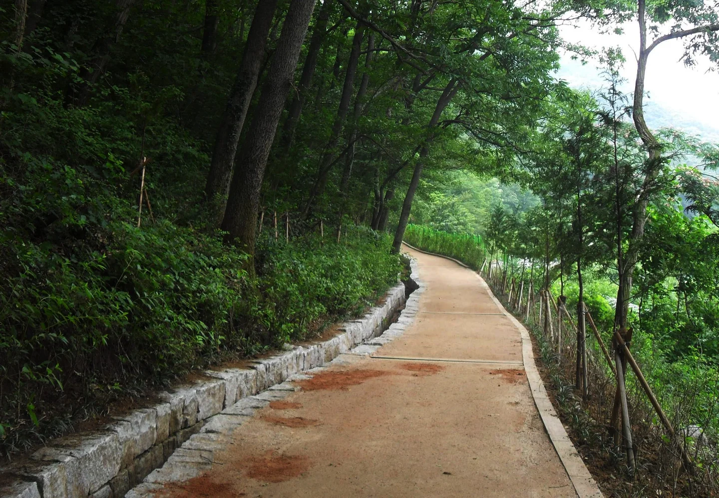
Mudeungsan Mountain forest path following the shade of trees

Korea.net / Korean Culture and Information Service · Original · CC BY-SA 2.0 ·

Source notices and processing details

Mudeungsan Mountain forest path following the shade of trees

Photo: Korea.net / Korean Culture and Information Service · commons.wikimedia.org — Mudeungsan Danim trail (7800583084).jpg · CC BY-SA 2.0

WebP conversion; proportionally reduced where needed; no cropping or upscaling.

Processed copies are provided under the same license shown above.

CC BY-SA 2.0 https://creativecommons.org/licenses/by-sa/2.0 · 저작자 표시 필수 · 동일조건변경허락(변경 시 같은 라이선스)

360 × 250: Existing supplied proportional WebP rendition; no new crop, resize, upscaling, distortion or synthesis in this connection batch.

720 × 499: Existing supplied proportional WebP rendition; no new crop, resize, upscaling, distortion or synthesis in this connection batch.

1440 × 998: Existing supplied proportional WebP rendition; no new crop, resize, upscaling, distortion or synthesis in this connection batch.

The park's Dangsannamu route links the Jeungsimsa parking area, the temple, a large old village guardian tree, and Jungmeorijae. The listed outward distance is about 2.5 miles, or 4 kilometers. Your return is additional, making this a real hike rather than a brief stroll from the temple courtyard. The route changes underfoot. The earlier approach is comparatively broad and maintained; farther up, stones, steps, and rougher ground require more attention. Hiking footwear with dependable grip is appropriate, along with water and food for the time you expect to be out. The park specifically notes the rocky upper portion even while describing this as a popular introductory route. Jungmeorijae opens into a broad saddle where several trails meet. It makes a useful destination for a rest and a look around before returning, but it is also a place to check the signs carefully. Match your intended descent with the map rather than simply following the next group of walkers. Wonhyosa is another approach area on a different side of the mountain. A hike starting at Jeungsimsa and finishing there needs an onward transport plan. For a first visit with a car left at Jeungsimsa, returning to the same side is easier to organize than an unplanned crossing.

Ipseokdae and Seoseokdae: Plan a Longer Day
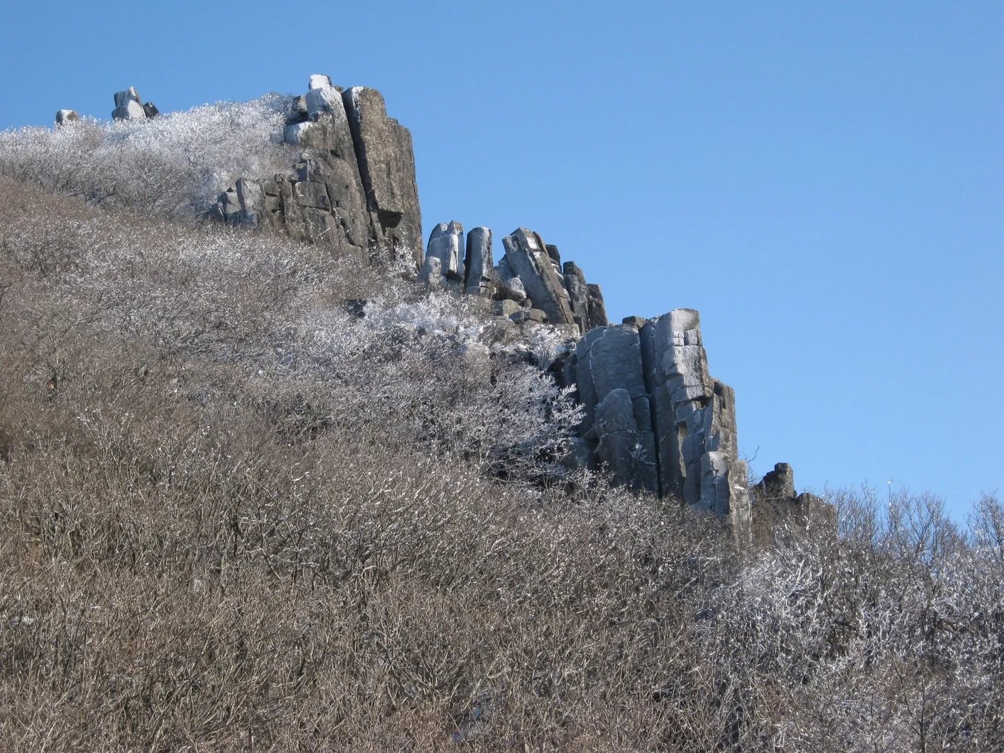
Vertical rock pillar on the ridge of Mudeungsan Mountain

gary4now · Original · CC BY 3.0 ·

Source notices and processing details

Vertical rock pillar on the ridge of Mudeungsan Mountain

Photo: gary4now · commons.wikimedia.org — Mt Mudeungsan - panoramio - gary4now (1).jpg · CC BY 3.0

WebP conversion; proportionally reduced where needed; no cropping or upscaling.

CC BY 3.0 https://creativecommons.org/licenses/by/3.0 · 저작자 표시 필수

360 × 270: Existing supplied proportional WebP rendition; no new crop, resize, upscaling, distortion or synthesis in this connection batch.

720 × 540: Existing supplied proportional WebP rendition; no new crop, resize, upscaling, distortion or synthesis in this connection batch.

1440 × 1080: Existing supplied proportional WebP rendition; no new crop, resize, upscaling, distortion or synthesis in this connection batch.

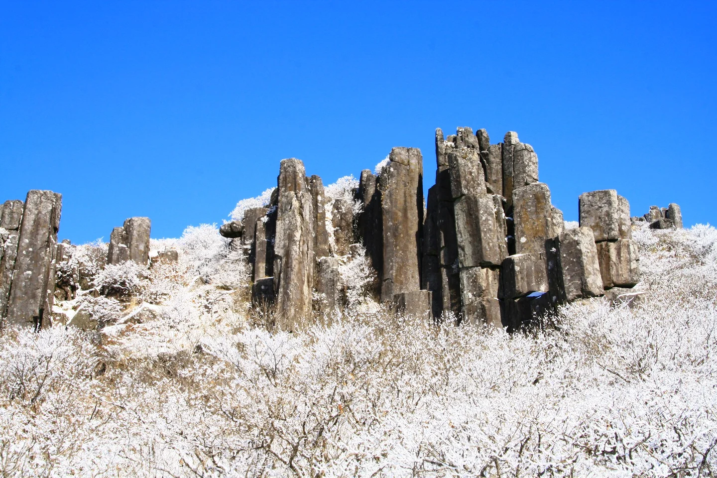
The upright rock columns of Mudeungsan are among its most distinctive sights. Around Ipseokdae and Seoseokdae, the repeated vertical forms stand above the vegetation and give the upper ridges a striking outline. Enjoy them from the designated paths and viewing areas, which protect both visitors and the landscape. From the Jeungsimsa side, continuing beyond Jungmeorijae toward Jangbuljae adds considerable climbing and distance. The park also describes a Saeinbong–Ipseokdae route that crosses several ridges and peaks. Its name identifies a destination, not a shortcut: the published 6.8-kilometer route reaches the upper formations before the descent is added. Choose a complete route, including the way down, rather than combining attractive names as you go. Seoseokdae is not Cheonwangbong, the mountain's highest peak. Normal access toward Inwangbong must also be distinguished from special openings through the military area near the summit. As checked October 12, 2026, the park's military-area reservation information limits applications to Korean nationals and requires identification. That restriction concerns the special controlled section; it is not a ban on international visitors using Mudeungsan's ordinary open trails. If considering an extension to Inwangbong, ask the park about that route's current access and cutoff before the hike. Keep military-area special events out of an ordinary itinerary unless you meet their stated conditions. Poor visibility or strong ridge winds are good reasons to shorten an upper route rather than add another destination.

Snow, Visibility, and the Return Walk
Mudeungsan Mountain’s columnar joints covered in snow

Seong Ilhan · Original · CC BY-SA 4.0 ·

Source notices and processing details

Mudeungsan Mountain’s columnar joints covered in snow

Photo: Seong Ilhan · commons.wikimedia.org — 무등산 주상절리대.jpg · CC BY-SA 4.0

WebP conversion; proportionally reduced where needed; no cropping or upscaling.

Processed copies are provided under the same license shown above.

CC BY-SA 4.0 https://creativecommons.org/licenses/by-sa/4.0 · 저작자 표시 필수 · 동일조건변경허락(변경 시 같은 라이선스)

360 × 240: Existing supplied proportional WebP rendition; no new crop, resize, upscaling, distortion or synthesis in this connection batch.

720 × 480: Existing supplied proportional WebP rendition; no new crop, resize, upscaling, distortion or synthesis in this connection batch.

1440 × 960: Existing supplied proportional WebP rendition; no new crop, resize, upscaling, distortion or synthesis in this connection batch.

Snow and frost can emphasize the rock columns and coat the surrounding vegetation, giving the upper mountain a very different appearance. Those conditions also change the demands of the hike. Dry streets in Gwangju do not tell you whether shaded trails higher up are icy. A winter ascent requires suitable experience, traction equipment, and protection from cold and wind, as well as confirmation that the route is open. If you are unfamiliar with winter mountain walking, choose a lower open route or another day instead of relying on equipment alone. The seasonal landscape is a reason to plan carefully, not to extend a hike beyond your preparation. Allow extra time for slow sections and the descent.
Gwangju cityscape seen from Mudeungsan Mountain

VaneTrz20 · Original · CC BY-SA 4.0 ·

Source notices and processing details

Gwangju cityscape seen from Mudeungsan Mountain

Photo: VaneTrz20 · commons.wikimedia.org — View from Mudeungsan.jpg · CC BY-SA 4.0

WebP conversion; proportionally reduced where needed; no cropping or upscaling.

Processed copies are provided under the same license shown above.

CC BY-SA 4.0 https://creativecommons.org/licenses/by-sa/4.0 · 저작자 표시 필수 · 동일조건변경허락(변경 시 같은 라이선스)

360 × 203: Existing supplied proportional WebP rendition; no new crop, resize, upscaling, distortion or synthesis in this connection batch.

720 × 405: Existing supplied proportional WebP rendition; no new crop, resize, upscaling, distortion or synthesis in this connection batch.

1440 × 811: Existing supplied proportional WebP rendition; no new crop, resize, upscaling, distortion or synthesis in this connection batch.

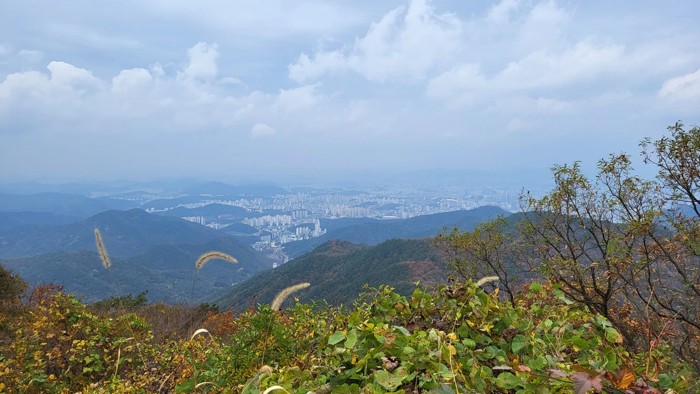
Where the trail opens toward Gwangju, the city below helps you appreciate how quickly the surroundings have changed. Haze can soften the distant buildings while leaving the nearby ridges and forest clear. Take the view that the day offers without chasing better visibility along an unplanned branch of the route. Before descending, confirm the correct trail back to your chosen entrance area and the transport you will use afterward. A restaurant near the lower visitor district can make a welcome finish once you are off the mountain. Keep the day centered on the route you selected: temple and forest, Jungmeorijae, or a properly planned hike to the upper rock formations.

SourcesKNPS Mudeungsan official park page directly read: mountain/rocklandscape, currentnotice links and trail-map/access planning.: https://mudeung.knps.or.kr/front/portal/visit/visitCourseMain.do?menuNo=7020090&parkId=122000 KNPS Dangsannamu route directly read: parking–temple–tree–Jungmeorijae4km outward, rocky latersection and hikingfootwear. Optimistic1h35 duration not promised.: https://www.knps.or.kr/front/portal/visit/visitCourseGuide.do?parkId=122000&vcursId=122000V003 KNPS Saeinbong–Ipseokdae route directly read:6.8km ascendingmulti-peakroute,returnseparate; rocky ridges and waterpreparation. No blanket never-get-lost claim reused.: https://www.knps.or.kr/front/portal/visit/visitCourseGuide.do?parkId=122000&vcursId=122000V001 KNPS entrycutoff page directly read: route/season-specifichours,not a universal safe latest departuretime.: https://www.knps.or.kr/portal/main/contents.do?menuNo=8000198&parkId=122000 KNPS special summit reservation directly read: military-area section,Korean-national applications and ID required. Not generalizedtoordinaryparkaccess.: https://res.knps.or.kr/contents/T/serviceGuide.do?parkId=B17&prdDvcd=T Gwangju2025 official announcement directly read: specialmilitaryopening distinguishedfromnormalInwangbongroute; oldeventdate/shuttleexpansion omitted.: https://tour.gwangju.go.kr/home/board/B0049.cs?act=read&articleId=7434&m=356&pageIndex=1&searchCondition=&searchKeyword= AcademyofKoreanStudies Jeungsimsa history entry updatedJuly2026 directly read: survivingO-baekjeon versus reconstructedhalls andtemplesetting.: https://encykorea.aks.ac.kr/Article/E0054041 확인일: 2026-10-12 (Asia/Seoul). 기본 근거: jeolla-025 한국어 완료 원고의 사실·선택 사진. 영어는 독립 구성·집필.

Travel guide