Taejongdae: Busan's Cliffs, Forest Walks, and Yeongdo Lighthouse
Christophe95 · Original · CC BY-SA 4.0 ·
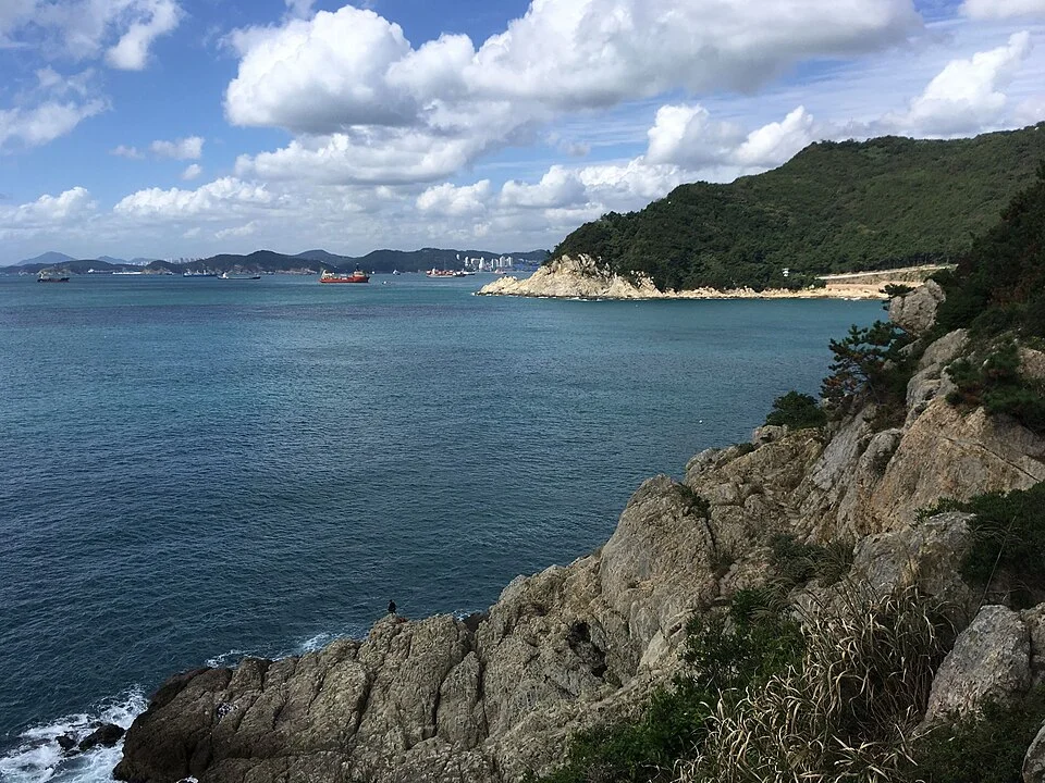
At Taejongdae, the attraction is the edge of the land. Forest runs right up to pale cliffs, ships cross the open water, and waves gather in small coves below the trees. This is the Busan outing to choose when you want a rugged coastline and a substantial walk. You can spend a morning moving between broad sea views and the closer detail of layered rock, then return to Nampo for lunch or continue exploring Yeongdo Island. The park occupies Yeongdo's southern end, well beyond its bridge approaches. Reaching the entrance is only the first part of the trip: the principal viewpoints sit along a wooded circuit, with extra stairs leading down toward Yeongdo Lighthouse. Plan around two decisions: how much of that circuit you want to walk, and whether everyone in your group wants the lighthouse descent. The observatory gives you a rewarding sea view without committing to the lower coastal steps. For a first visit, allow roughly half a day including the journey from central Busan. That is a planning allowance, not a fixed walking time. A stop at the observatory can be relatively brief; transport queues, the lighthouse, and additional forest walking make a much longer outing. On a clear day, leave room to linger by the water rather than filling the afternoon with several distant neighborhoods.
Getting there, and an important transport change
Michiel1972 · Original · CC BY-SA 3.0 ·
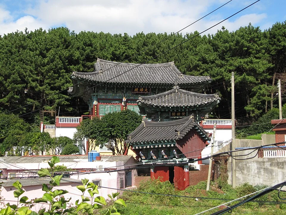
Taejongdae has no subway station at its gate. From Busan Station or Nampo, continue by a city bus heading onto Yeongdo and get off at the Taejongdae stop. When checking directions, use the park's main entrance as your destination, rather than a pin for the lighthouse deep inside the grounds. A taxi also leaves you with the internal park journey to consider; it should not be treated as door-to-door access to every coastal viewpoint. Before starting uphill, look at the entrance map and locate the observatory, lighthouse turnoff, and your intended return route. The circuit is not a flat seafront promenade. Much of it passes through trees, and places that look close together on the map can sit at different elevations. There are temple buildings around the approach as well as Taejongsa farther inside the park, so follow the named signs if you want to include that particular temple. Transport update, checked October 12, 2026: the Busan Tourism Association's July 10 notice reports that the Danubi tourist train is suspended for an emergency safety inspection and a free replacement shuttle has been introduced. Free, first-come departure tickets are issued at the Danubi ticket office. If you need a ride to reach the viewpoints, check the current service notice before traveling; older attraction pages still describe normal train operation. Confirm the replacement vehicle's wheelchair arrangements separately if needed.
Make the observatory your first main stop
User:Altostratus · Original · CC BY-SA 4.0 ·
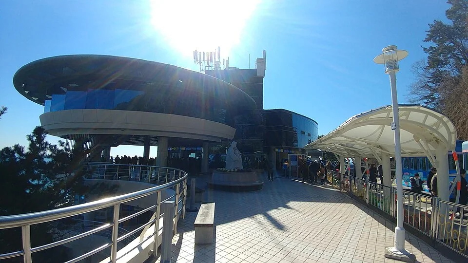
The rounded observatory building provides a useful pause between the forest road and the exposed coast. Take in the shape of the shoreline first, then pick out the vessels farther offshore. Taejongdae's appeal includes the working sea: ships waiting or moving outside Busan's harbor give scale to water that otherwise seems to stretch indefinitely. This is also the sensible point to decide how much farther to go. If someone is tired, or the group wants an easier visit, concentrate on the accessible viewing areas rather than automatically adding the lighthouse stairs. Ask the entrance information center about the current route to the observatory for a wheelchair or stroller. A vehicle reaching a nearby stop does not establish step-free access to every deck or coastal path. Visibility changes the experience. Sea mist may hide the distant horizon while leaving the nearer cliffs sharply visible; bright weather opens the view but can make exposed stops much hotter than the wooded approach. Choose a place to sit and watch for a while. Identifying a faraway island is optional, and a clear view of distant land should never be the sole reason for making the trip.
The lighthouse rewards the extra stairs
theaucitron · Original · CC BY-SA 2.0 ·
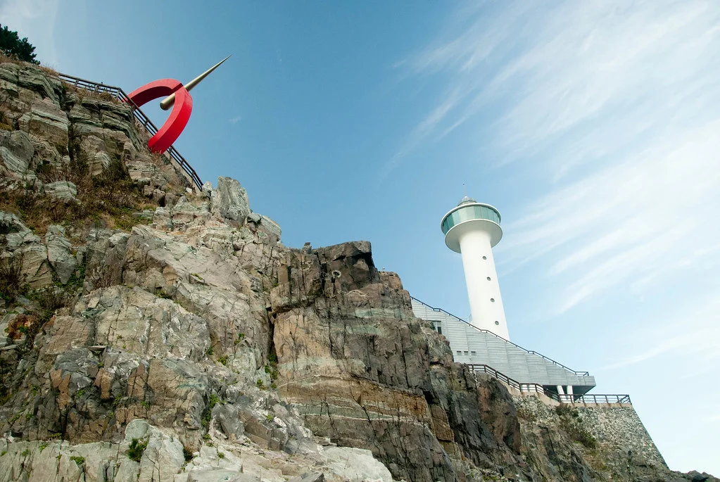
At the lighthouse turnoff, the visit becomes more physical. The route descends from the circuit toward the headland, bringing the white tower, rock faces, and sea into the same field of view. This is where the coastline feels close enough to understand its structure: layers run across the exposed cliffs, and the water breaks against their base. Yeongdo Lighthouse first shone in December 1906 and has guided ships approaching Busan ever since. The present facilities were rebuilt in 2004, so the tower's history is older than the structure you see today. Its position makes immediate sense with the harbor traffic below. You are visiting a navigation landmark as well as a scenic stop. The Ministry of Oceans and Fisheries' account explains that history and rebuilding. Allow for the climb back up before starting down. If your party splits, agree to meet at the clearly signed turnoff on the circuit, not simply “at the lighthouse,” which can mean several different levels. The lower visit is worthwhile for the close-up cliff setting, but it is a choice, not a requirement for seeing Taejongdae. Keep enough energy for the return to the entrance.
Read the coast in its rock layers
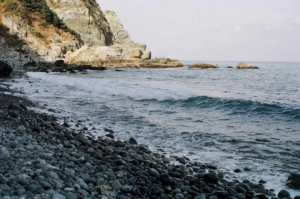
The coves add another texture to the walk. Rounded stones gather where a sandy beach might otherwise be, and waves pull back across them beneath steep rock walls. Treat these as coastal viewpoints rather than assuming every bay is a swimming beach or an easy route down to the water. The view from an open path is often the best way to see how a cove fits into the larger headland. Taejongdae's layered rocks began as sediments deposited in an ancient lake. Later uplift and wave erosion helped create the cliffs visible today. You do not need a geology background to notice the result: bands of different shades, uneven ledges, and hollows worn near the sea. Looking across the face of a cliff makes those layers easier to follow than standing immediately against it. Leave Sinseon Rock off any itinerary that assumes you can walk out onto it. Access restrictions were still reported in October 2026, and older photographs and travel accounts are not evidence that the rock platform is open. Use the viewing areas and paths that are actually open when you visit. This matters especially here, where a tempting shortcut can lead toward a closed coastal section rather than back to the main circuit.
Finish with forest, or continue around Yeongdo
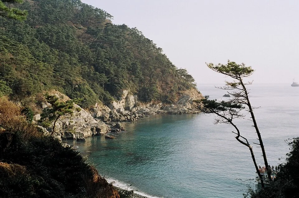
If walking is part of the attraction, give the wooded circuit some time beyond the main stops. The change from a shaded stretch to a sudden opening over the sea is part of Taejongdae's rhythm. Expect intervals without a view; this is a forested headland, not an uninterrupted waterfront boardwalk. Taejongsa makes an optional temple stop for those continuing through the park, with seasonal flowers an extra rather than a year-round promise. For an island-focused day, pair Taejongdae with Huinnyeoul Culture Village. Allow a separate bus or taxi transfer between them: one offers forest and cliffs, the other residential lanes and cafés above the water. Alternatively, return to Nampo for the food stalls around BIFF Square or a meal near the markets. Keep the park earlier in the day if you have a fixed train departure afterward; the internal return journey comes before the bus ride back across Yeongdo's bridges.