Hiking Geumjeongsan: Choose a Summit, a Fortress Walk, or Both
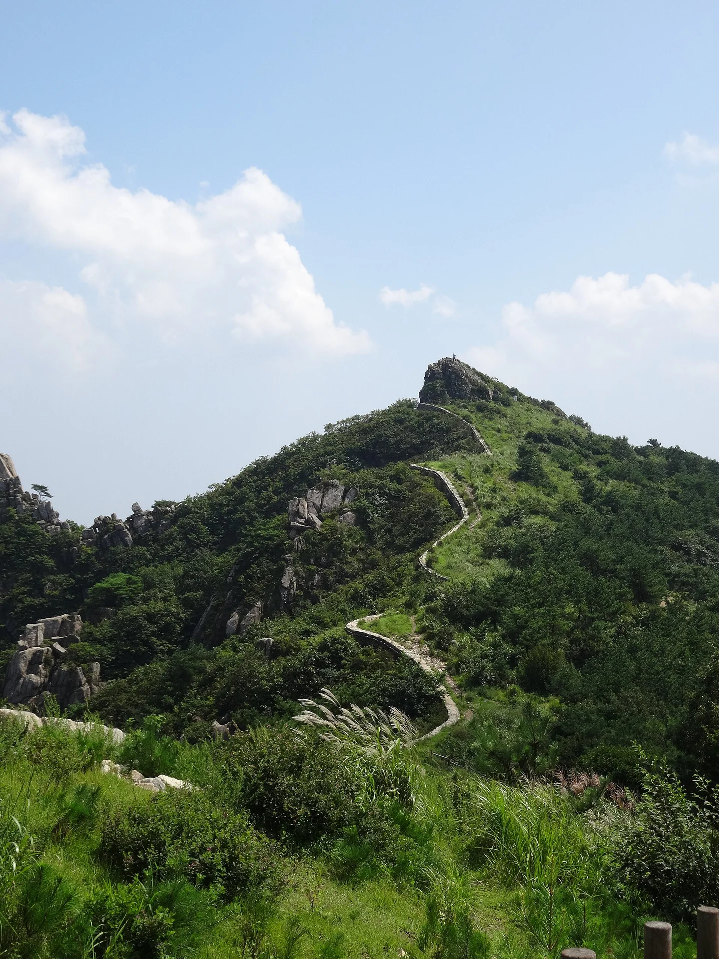
A stone fortress wall follows the rise and fall of Geumjeongsan's ridges, disappearing behind granite outcrops and returning on the next slope. This is one of Busan's most rewarding landscapes for a hiking day: wooded approaches, open hilltops, and a historic wall that gives the walk a clear visual thread. Godangbong is the highest peak, but reaching it is only one way to explore the mountain. The most useful first decision is where you want to finish. A return hike from Beomeosa keeps transport simple. An East Gate-to-North Gate walk, followed by a descent to Beomeosa, lets you cover more varied ground without retracing the ridge. A short outing around a bus-accessible fortress gate suits travelers who want the mountain setting without a summit climb. These are different trips, so “Geumjeongsan” alone isn't a precise enough destination for your map. Geumjeongsan became a national park in 2026. The Korea National Park Service's current park page is the starting point for trail notices and access information. Check the specific sections you intend to use on the day of your hike. Older descriptions of unrestricted access don't establish current conditions, and a green status today doesn't guarantee the same route will be open after heavy rain.
Start at Beomeosa for the North Gate and Godangbong
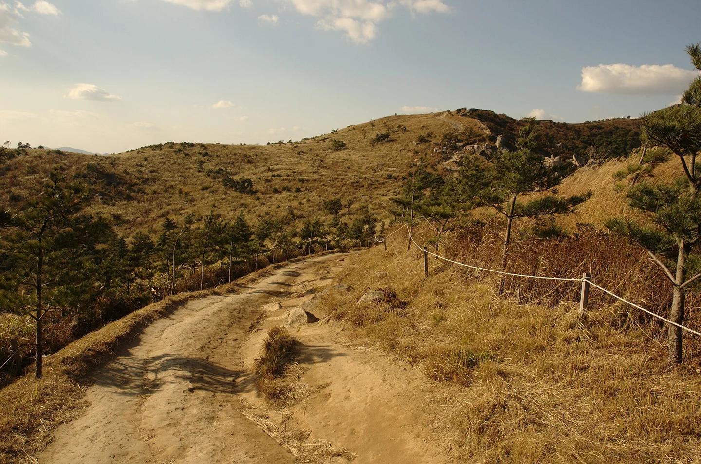
The Beomeosa approach makes sense if Godangbong is your main goal. Take Metro Line 1 to Beomeosa Station, then bus 90 uphill to the temple area. The temple's directions place the connecting bus stop a short walk from exits 5 and 7. The temple is several kilometers beyond the station, so don't count the metro arrival as the start of your mountain trail. At the trailhead, identify signs for Bukmun, the North Gate. The temple courtyards and the hiking route serve different purposes; include separate time for Beomeosa if you want to visit both. Beginning with a long temple visit and then setting off toward the summit late in the afternoon is an easy way to run short of daylight. The North Gate gives you a useful decision point. Continue toward Godangbong only with enough time and energy for the descent as well. A walk to the gate and back still brings together woodland and fortress architecture, and it avoids committing to the more exposed summit section when the weather is poor. Pay attention to the endpoint when reading a named itinerary. Geumjeong District's full “Beomeosa Temple Path” is a 7.4-kilometer route that goes from the temple to the North Gate and Godangbong, returns to the North Gate, then continues past watchtowers to the East Gate. Its published estimate is about 3½ hours, before whatever extra time you need for temple sightseeing, meals, and rests. That is a through-hike, not a short loop back to your original bus stop. The district route guide makes the sequence clear.
Start at the East Gate for the fortress ridge
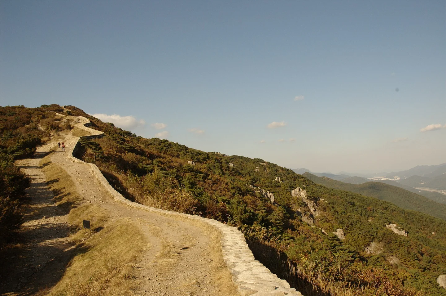
If the wall and ridge scenery interest you more than the highest summit, consider approaching from Dongmun, the East Gate. Geumjeong District lists Metro Line 1 to Oncheonjang, followed by bus 203 to the East Gate entrance or Sanseong Pass. This saves much of the climb from the city, but the trail beyond the gate still has repeated ascents, descents, and uneven ground. The official transport guide, checked October 12, 2026, distinguishes this approach from the Beomeosa connection. For a flexible first walk, choose an out-and-back section from the gate and set a turnaround time. A longer option follows the ridge past the third and fourth watchtowers toward the North Gate, then descends to Beomeosa. Public transportation is particularly useful for that one-way plan. With a rental car, you would still need to get back to the parking place on the other side of the mountain. The wall is most striking where it rises toward a rocky crest. Stand back on the designated path to see its line against the slopes, then look more closely at the stonework as the trail brings you alongside it. The ground underfoot alternates between dirt and rock, so the appearance of a long, continuous wall shouldn't suggest a level promenade. Save a map showing the gates, watchtowers, and your intended descent before setting out. At a junction, the name of your next landmark is more useful than simply following “uphill.” Carrying on toward a different gate can leave you in a different neighborhood from the one where you planned to catch your bus.
Granite outcrops and the story of Geumsaem
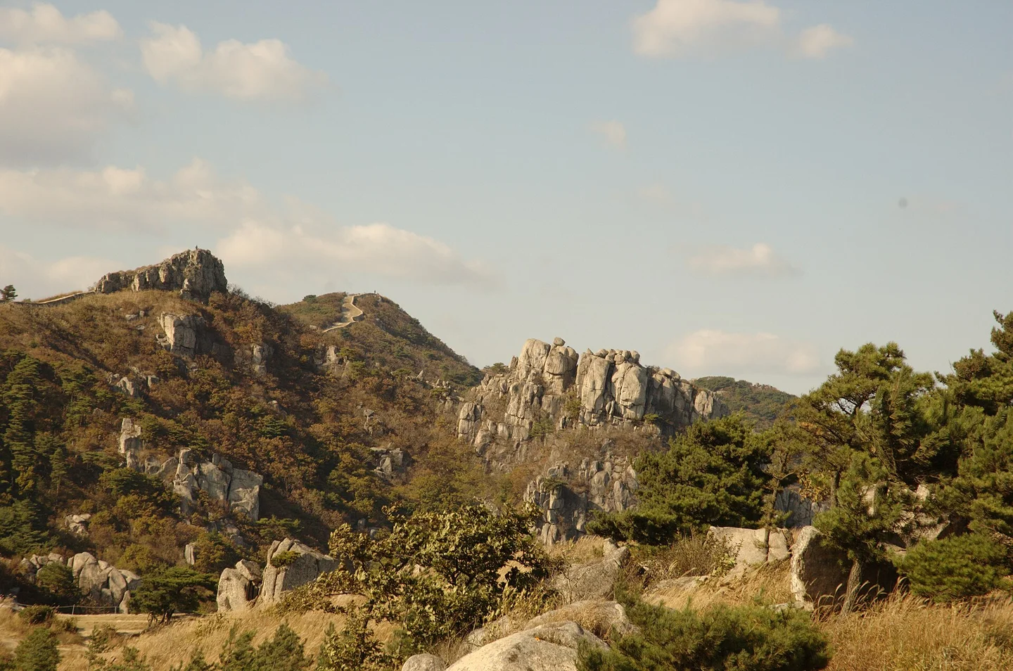
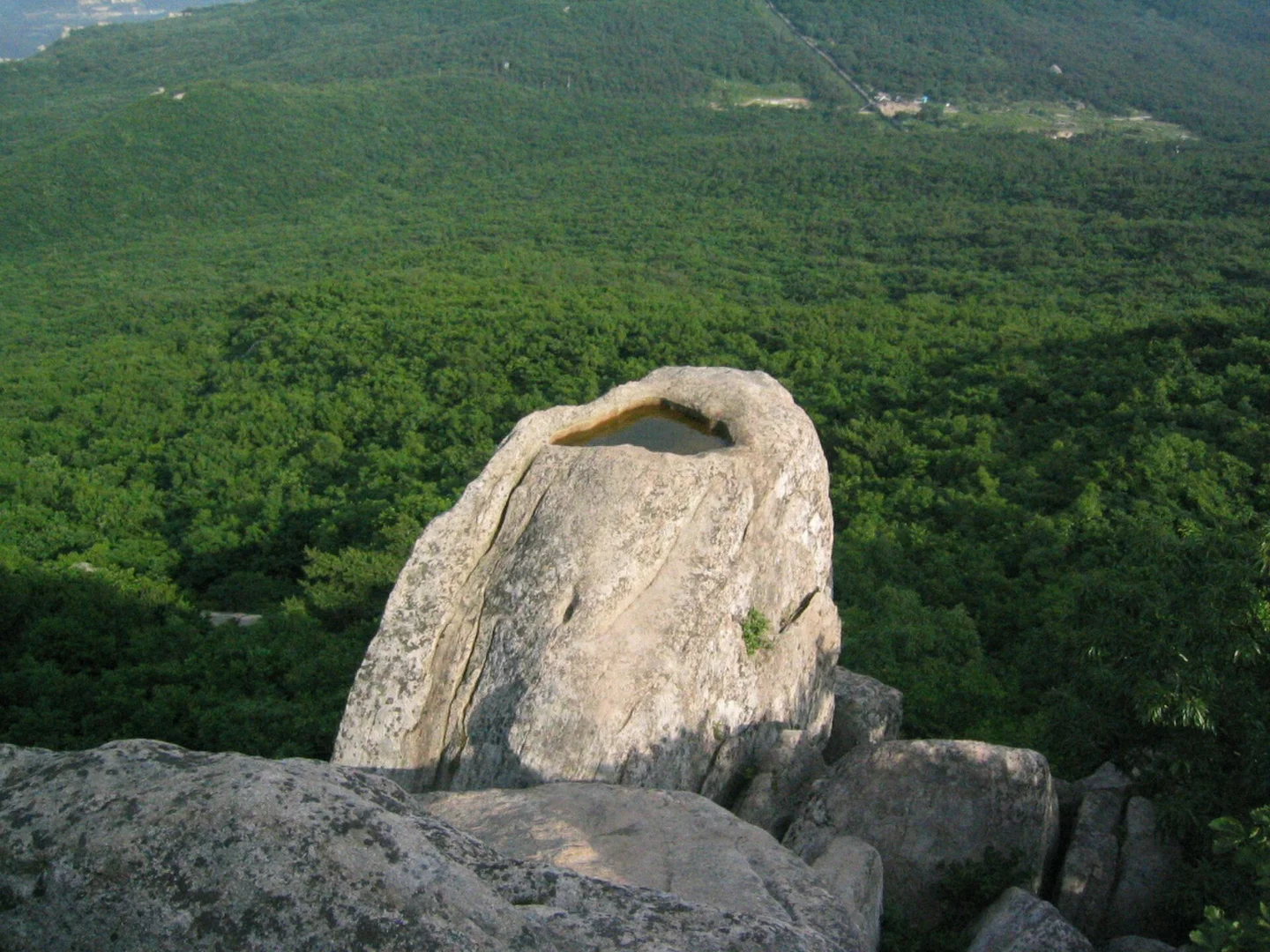
Geumjeongsan's granite is a major part of its character. Cracks divide some outcrops into tall, block-like columns, while other rocks have weathered into rounded masses. The changing shapes make the walk interesting even when distant city views are hazy. From a safe stopping place, compare the bare rock faces with the trees growing around them to get a sense of their scale. Godangbong's upper section is more exposed than the wooded approach. Wind, wet rock, and congestion around narrow passages can change the pace considerably. Plan a summit as a weather-dependent objective, and leave room in the schedule for a slower descent. A clear view is a bonus rather than something a particular departure time can guarantee. Geumsaem's small pool has a large place in local legend
Rémi Cormier · Original · CC BY-SA 3.0 ·
Near Godangbong, Geumsaem is a water-holding hollow on top of a prominent rock. A local legend tells of a golden fish descending from the sky to swim there, connecting the names of Geumjeongsan and Beomeosa. The geological feature and the story are both worth knowing: one explains the rock's form, while the other gives it cultural significance. The city's Geopark guide describes the mountain's granite landscapes and this landmark. Treat Geumsaem as an optional part of the walk, subject to the signed route and current access conditions. Don't climb onto an exposed rock or cross a barrier to look into the hollow. There are plenty of opportunities to appreciate the mountain's geology from the regular trail.
Build your descent around Sanseong Village or the metro
Kevin Rawlings · Original · CC BY-SA 4.0 ·
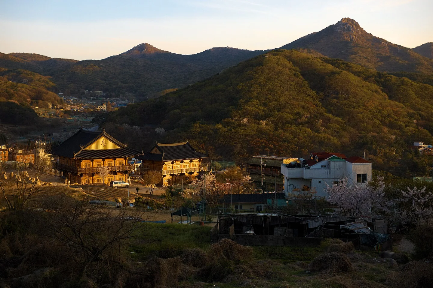
Sanseong Village offers a different ending, with houses and restaurants tucked into the mountain landscape. Choose it as your descent destination in advance rather than assuming any path dropping off the ridge will reach the village. If some of your group aren't hiking, a clearly named restaurant or bus stop there can make a practical meeting point, with time allowed for the walkers' actual progress. Keep a sit-down meal for after the mountain section. If you're interested in the area's makgeolli, the cloudy Korean rice drink, leave it until the hiking is finished and you're no longer driving. Bring your own drinking water and a snack for the trail rather than relying on a mountain vendor or untreated spring. For equipment, prioritize grippy walking or hiking shoes, weather-appropriate layers, a charged phone with a saved route, and enough water for the planned distance. The open ridge can be hot in summer and windy in cooler months. In heavy rain, thick fog, strong wind, or a thunderstorm forecast, shorten or postpone an exposed route. The park service's trail-control page provides the final access check. Set your return time by the full descent and transport connection, not by when you expect to reach the summit. Finishing at Beomeosa brings you back toward Line 1 via bus 90; finishing near the East Gate means arranging the appropriate bus connection from that side. Knowing which ending you've chosen lets you spend the walk looking at the fortress and granite ridges instead of solving the journey home halfway down the mountain.