gil.KOREA

Yudalsan, Mokpo: A Rocky Mountain Above the Harbor
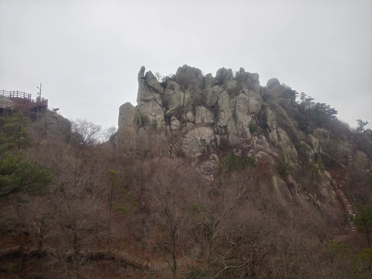
Yudalsan Mountain’s rocky peak and hiking stairs

Brianjapan · Original · CC0 1.0 ·

Source notices and processing details

Yudalsan Mountain’s rocky peak and hiking stairs

Photo: Brianjapan · commons.wikimedia.org — 20240225 View of Yudal Mountain, Korea.jpg · CC0 1.0

WebP conversion; proportionally reduced where needed; no cropping or upscaling.

CC0 http://creativecommons.org/publicdomain/zero/1.0/deed.en · 저작자 표시 불필요(권장)

360 × 270: Existing supplied proportional WebP rendition; no new crop, resize, upscaling, distortion or synthesis in this connection batch.

720 × 540: Existing supplied proportional WebP rendition; no new crop, resize, upscaling, distortion or synthesis in this connection batch.

1440 × 1080: Existing supplied proportional WebP rendition; no new crop, resize, upscaling, distortion or synthesis in this connection batch.

Yudalsan rises close behind Mokpo's old downtown, its exposed rocks visible above the streets. Walking uphill changes your understanding of the city a little at a time. First the nearby roofs fall below you, then the waterfront opens up, and finally islands and shipping channels become part of the view. It is an unusually direct way to connect a city walk with a mountain landscape. The mountain's proximity can be misleading, though: this is a rocky climb with steps, not a level urban park. You can enjoy it at several scales. Keep a short visit around Nojeokbong and the entrance, climb to a pavilion or intermediate viewpoint, or make Ildeungbawi, the highest peak, your main goal. The perimeter trail offers another option and follows a different route from the summit paths. For a first visit, use Nojeokbong and the main Yudalsan entrance as your starting area. From Mokpo Station, approach through the old downtown or take a taxi to the entrance, depending on how much walking you want before the climb. Allow time for both the town-to-trail connection and the descent. If you also want to visit a museum, its admission cutoff will help determine which part of the day belongs on the mountain.

Start at Nojeokbong
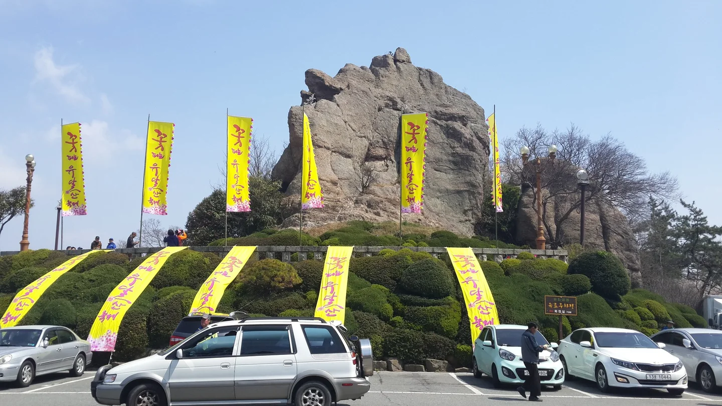
Nojeokbong Peak near the entrance to Yudalsan Mountain

Mar del Este · Original · CC BY-SA 4.0 ·

Source notices and processing details

Nojeokbong Peak near the entrance to Yudalsan Mountain

Photo: Mar del Este · commons.wikimedia.org — Yudalsan Mokpo Nojeokbong peak.jpg · CC BY-SA 4.0

WebP conversion; proportionally reduced where needed; no cropping or upscaling.

Processed copies are provided under the same license shown above.

CC BY-SA 4.0 https://creativecommons.org/licenses/by-sa/4.0 · 저작자 표시 필수 · 동일조건변경허락(변경 시 같은 라이선스)

360 × 202: Existing supplied proportional WebP rendition; no new crop, resize, upscaling, distortion or synthesis in this connection batch.

720 × 405: Existing supplied proportional WebP rendition; no new crop, resize, upscaling, distortion or synthesis in this connection batch.

1440 × 810: Existing supplied proportional WebP rendition; no new crop, resize, upscaling, distortion or synthesis in this connection batch.

Nojeokbong is the prominent rock formation beside the entrance area. It is an easy landmark for orienting yourself between the old streets and the mountain, and a worthwhile stop even if you do not plan to climb higher. Its position near the road also makes the distinction clear: Nojeokbong is not the summit you reach by following the upper trails. Look at the trail map here before choosing a route. A short walk to a view and back is often a better match for a city-sightseeing day than a full traverse between peaks. If hiking is your main purpose, identify both your intended destination and the way you will descend. Paths that appear close together on a map can involve different stairways and changes of elevation.
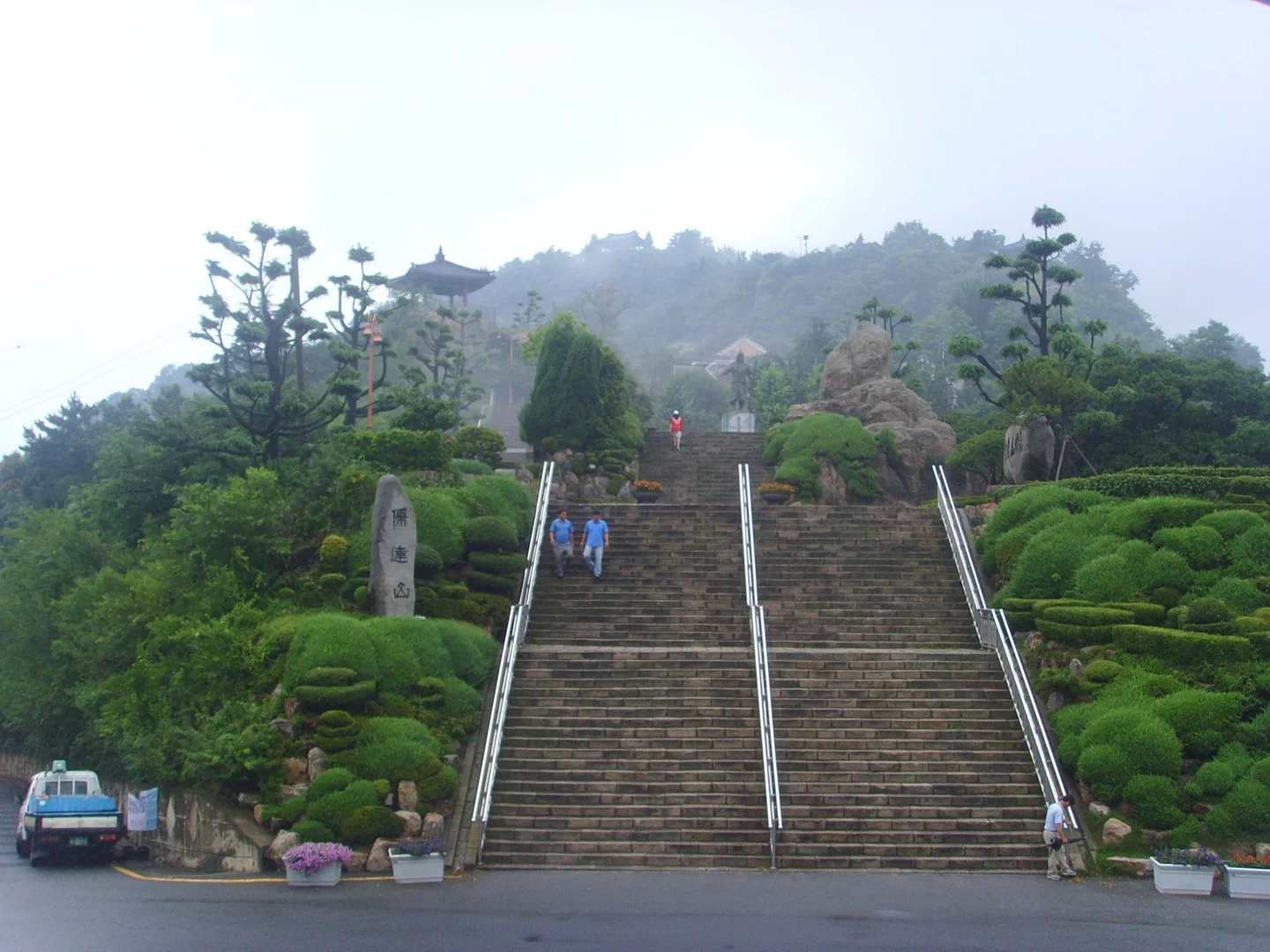
Wide stone steps at the entrance to Yudalsan Mountain

冥想 · Original · CC BY 3.0 ·

Source notices and processing details

Wide stone steps at the entrance to Yudalsan Mountain

Photo: 冥想 · commons.wikimedia.org — 유달산정문 - panoramio.jpg · CC BY 3.0

WebP conversion; proportionally reduced where needed; no cropping or upscaling.

CC BY 3.0 https://creativecommons.org/licenses/by/3.0 · 저작자 표시 필수

360 × 270: Existing supplied proportional WebP rendition; no new crop, resize, upscaling, distortion or synthesis in this connection batch.

720 × 540: Existing supplied proportional WebP rendition; no new crop, resize, upscaling, distortion or synthesis in this connection batch.

1440 × 1080: Existing supplied proportional WebP rendition; no new crop, resize, upscaling, distortion or synthesis in this connection batch.

The broad stone stairs at the entrance lead quickly into a more mountainous setting. Climb at a pace that lets you notice the city appearing behind you. The upper routes narrow and turn among rocks, so the first staircase is only an introduction to the terrain ahead. Mokpo's official hiking guide describes routes around Yuseongak Pavilion, Gwanungak Pavilion, Madangbawi, and Ildeungbawi. These are individual landmarks rather than a single straight staircase to the top. Follow the current signs at junctions, particularly around the rocky viewpoints, and give yourself time to retrace or complete the chosen route. Connecting Ildeungbawi and Ideungbawi makes a longer walk than simply climbing to the first open view. Shoes with reliable grip are useful on the stone steps, especially after rain. Descending can be more demanding on knees than the climb suggests. Choose a turning point while you still feel comfortable, and use the maintained paths instead of trying to cross the exposed rocks between them.

Pavilions and the Perimeter Trail
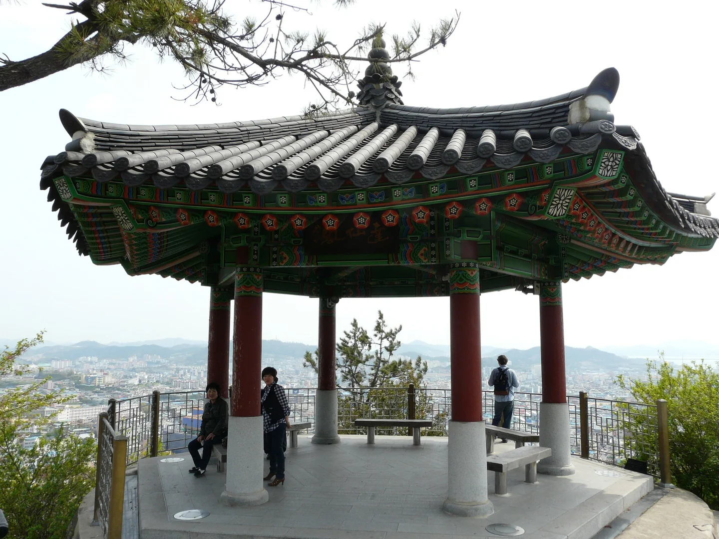
Yudal Mountain pavilion overlooking the city

myself (User:Piotrus) · Original · CC BY-SA 3.0 ·

Source notices and processing details

Yudal Mountain pavilion overlooking the city

Photo: myself (User:Piotrus) · commons.wikimedia.org — Mokpo028.JPG · CC BY-SA 3.0

WebP conversion; proportionally reduced where needed; no cropping or upscaling.

Processed copies are provided under the same license shown above.

CC BY-SA 3.0 https://creativecommons.org/licenses/by-sa/3.0 · 저작자 표시 필수 · 동일조건변경허락(변경 시 같은 라이선스)

360 × 270: Existing supplied proportional WebP rendition; no new crop, resize, upscaling, distortion or synthesis in this connection batch.

720 × 540: Existing supplied proportional WebP rendition; no new crop, resize, upscaling, distortion or synthesis in this connection batch.

1440 × 1080: Existing supplied proportional WebP rendition; no new crop, resize, upscaling, distortion or synthesis in this connection batch.

Yudalsan's pavilions break the climb into manageable stages. Stop beneath the eaves and the view shifts from the next step underfoot to the city below. Each rests in a different position on the mountain, so reaching the highest point is only one way to enjoy the landscape. For mixed-ability groups, a pavilion or nearby viewpoint can be a useful shared destination. The mountain is also known for rock formations whose names suggest animals, faces, and everyday objects. Mokpo's hiking guide gathers the stories attached to them. Treat the descriptions as local folklore and a way of looking at the shapes, rather than a checklist that requires leaving the trail to find every likeness. If you prefer a longer walk around the mountain's sides, consider a section of the Yudalsan Dulle-gil, or perimeter trail. The city's route links places including Mokpo Sisa, Dalseongsa Temple, the sculpture park, Eomin-dongsan, and Nakjodae. It is a substantial circuit, not automatically a short or flat alternative to the summit. Pick a section around the places that interest you and check where that section brings you back into town. For travelers using wheelchairs or strollers, plan around the accessible entrance and park areas after checking local advice. Neither the rocky summit route nor the entire perimeter circuit should be assumed to offer a continuous step-free path.

Read the Harbor from Above
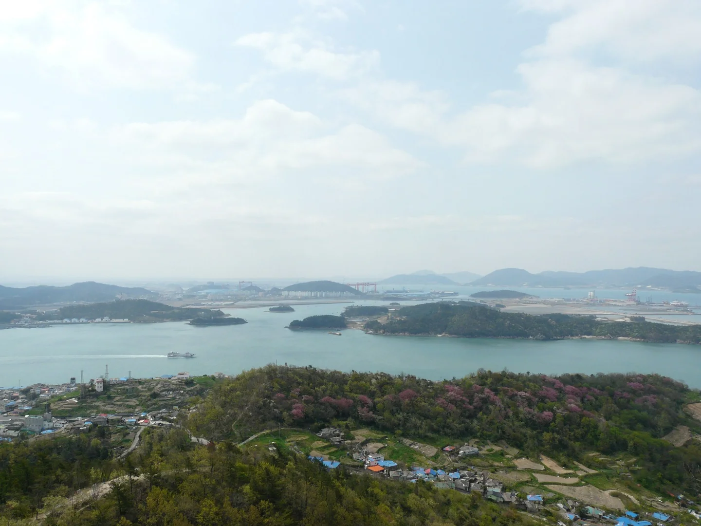
The port and sea seen from Yudalsan Mountain

myself (User:Piotrus)  This photo was taken with Panasonic Lumix DMC-FZ18 · Original · CC BY-SA 3.0 ·

Source notices and processing details

The port and sea seen from Yudalsan Mountain

Photo: myself (User:Piotrus)  This photo was taken with Panasonic Lumix DMC-FZ18 · commons.wikimedia.org — Skyline of Mokpo 20130428 114910.jpg · CC BY-SA 3.0

WebP conversion; proportionally reduced where needed; no cropping or upscaling.

Processed copies are provided under the same license shown above.

CC BY-SA 3.0 https://creativecommons.org/licenses/by-sa/3.0 · 저작자 표시 필수 · 동일조건변경허락(변경 시 같은 라이선스)

360 × 270: Existing supplied proportional WebP rendition; no new crop, resize, upscaling, distortion or synthesis in this connection batch.

720 × 540: Existing supplied proportional WebP rendition; no new crop, resize, upscaling, distortion or synthesis in this connection batch.

1440 × 1080: Existing supplied proportional WebP rendition; no new crop, resize, upscaling, distortion or synthesis in this connection batch.

At an open viewpoint, let your eye move from the nearest streets to the water. The harbor is an active landscape of boats, piers, channels, and islands, with the city fitted around its edges. If you walked up from the old downtown, try to pick out that direction. Returning to the streets afterward, you will have a clearer sense of where the water lies beyond the buildings. Visibility changes the experience. Clear weather brings distant outlines into focus; haze layers the hills and islands into softer bands. Even when the farthest view is limited, the nearby rocks, pines, and pavilions give the walk its character. Choose your route for the conditions on the mountain rather than for a particular distant sight you hope to photograph. For sunset, consider the descent as carefully as the climb. Illumination visible on the mountain from downtown does not mean every trail is well lit. First-time visitors may prefer to finish the walk in daylight and enjoy the lit ridgeline from below afterward. If you combine Yudalsan with the Marine Cable Car, allow separately for the walk from its intermediate station and the boarding arrangements; the ride does not replace every uphill section.

Bring the Walk Back to the Old Downtown
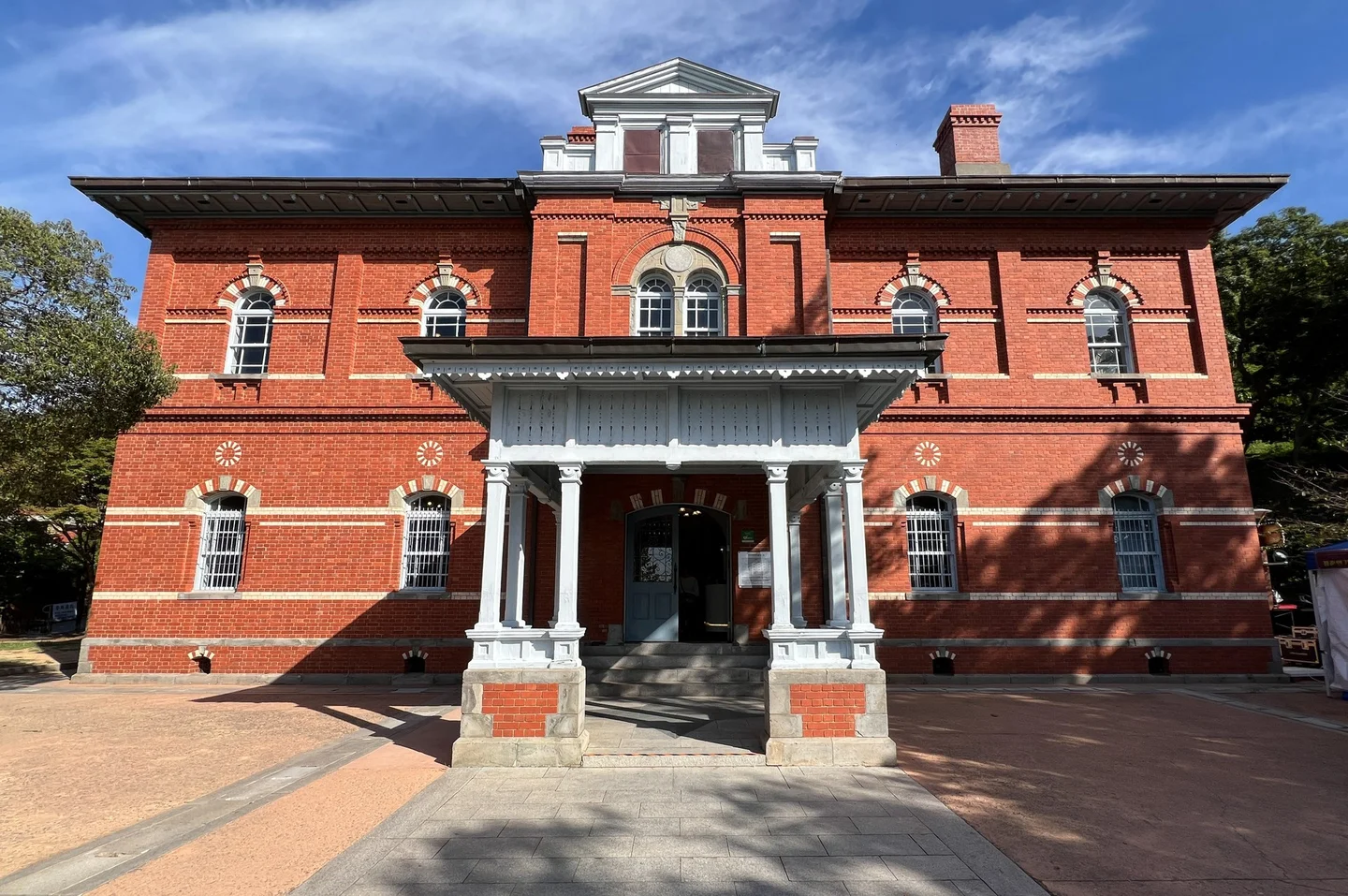
Mokpo Modern History Museum Building 1, the former Japanese Consulate in Mokpo

Mobius6 · Original · CC BY-SA 4.0 ·

Source notices and processing details

Mokpo Modern History Museum Building 1, the former Japanese Consulate in Mokpo

Photo: Mobius6 · commons.wikimedia.org — Mokpo Modern History Museum (Building 1) 20241005 001.jpg · CC BY-SA 4.0

WebP conversion; proportionally reduced where needed; no cropping or upscaling.

Processed copies are provided under the same license shown above.

CC BY-SA 4.0 https://creativecommons.org/licenses/by-sa/4.0 · 저작자 표시 필수 · 동일조건변경허락(변경 시 같은 라이선스)

360 × 239: Existing supplied proportional WebP rendition; no new crop, resize, upscaling, distortion or synthesis in this connection batch.

720 × 478: Existing supplied proportional WebP rendition; no new crop, resize, upscaling, distortion or synthesis in this connection batch.

1440 × 957: Existing supplied proportional WebP rendition; no new crop, resize, upscaling, distortion or synthesis in this connection batch.

Below the mountain, Mokpo Modern History Museum Hall 1 adds context to the port you have been viewing. The red-brick building was completed in 1900 as the Japanese consulate. Its exhibits trace Mokpo's development as a port city, Japanese colonial rule, resistance, and changes in everyday culture. The building's history makes it more than an architectural photo stop. The city's visitor information, checked October 12, 2026, lists Hall 1 hours as 9 a.m.–6 p.m., Tuesday–Sunday, with ticketing and entry ending at 5 p.m. Mondays are closed. If the exhibits matter to you, visit before the mountain walk when a later descent might miss that cutoff. Hall 2 is a different building, so use the hall number when finding the entrance. Afterward, the surrounding old downtown provides places to eat and rest before returning toward Mokpo Station. A short mountain visit pairs easily with the museum and a meal. For a day centered on walking, choose either a summit route or a longer perimeter section, then leave the remaining time for the streets below.

SourcesMokpo official hiking guide directly read: Nojeokbong and upper peaks distinguished, pavilion/rock routes and local folklore. Historical stories framed as folklore, no unsupported climb durations.: https://kid.mokpo.go.kr/tour/theme/climb/yudalsan_climbing Mokpo official perimeter-trail page directly read: separate circuit links Sisa,Dalseongsa,sculpturepark,Eomin-dongsan,Nakjodae; full circuit not treated as flat short walk.: https://www.mokpo.go.kr/tour/theme/climb/yudalsan_dullegil KTO Yudalsan loop-road attraction page directly read: geographic context; road and trail not conflated.: https://korean.visitkorea.or.kr/detail/ms_detail.do?cotid=12d6cf84-540e-4b5d-a2c3-bcbc9c8b0322 Mokpo Hall1 museum page directly read: former Japanese consulate completed1900, port/colonial/resistance/cultural exhibits; erroneous top administrative address discarded.: https://biz.mokpo.go.kr/tour/attraction/museum?idx=7449&mode=view Mokpo official admission page directly read: Hall1 09–18 Mondayclosed, ticketing and entry end one hour before closing.: https://biz.mokpo.go.kr/tour/tourguide/information/admission 확인일: 2026-10-12 (Asia/Seoul). 기본 근거: jeolla-019 한국어 완료 원고의 사실·선택 사진. 영어는 독립 구성·집필.

Travel guide