gil.KOREA

Tongyeong Cable Car and Mireuksan: a mountain view of the island-studded coast
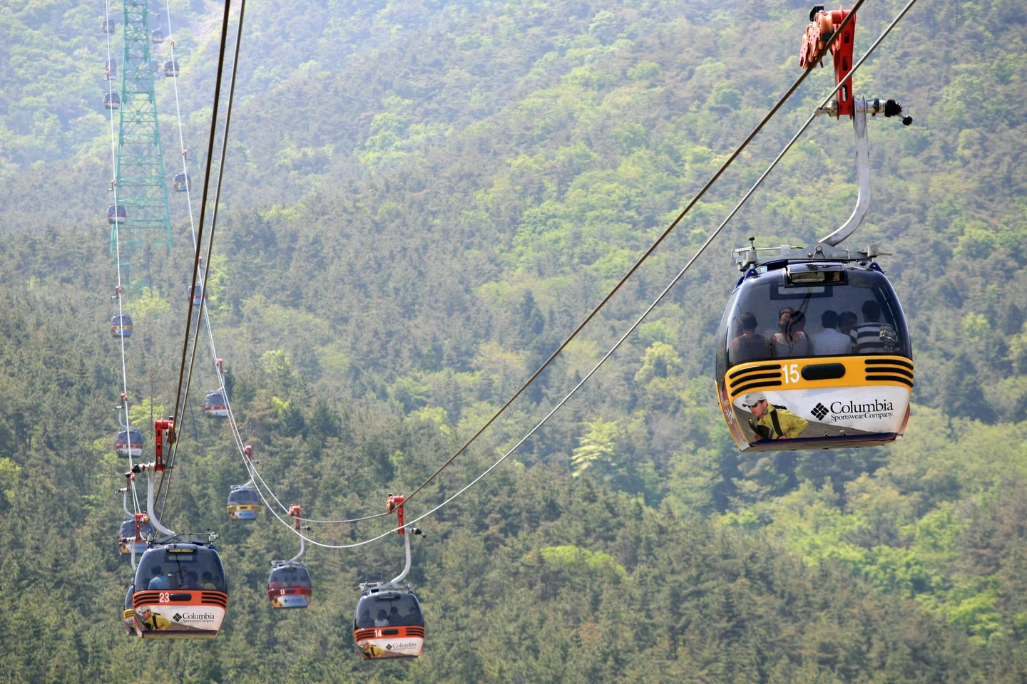
Tongyeong Cable Car traveling above the forest of Mireuksan

by Junho Jung at Flickr from South Korea · Original · CC BY-SA 3.0 ·

Source notices and processing details

Tongyeong Cable Car traveling above the forest of Mireuksan

Photo: by Junho Jung at Flickr from South Korea · commons.wikimedia.org — Korea-Tongyeong-Hallyeo Waterway Observation Cable Car-01.jpg · CC BY-SA 3.0

WebP conversion; proportionally reduced where needed; no cropping or upscaling.

Processed copies are provided under the same license shown above.

CC BY-SA 3.0 https://creativecommons.org/licenses/by-sa/3.0 · 저작자 표시 필수 · 동일조건변경허락(변경 시 같은 라이선스)

360 × 240: Existing supplied proportional WebP rendition; no new crop, resize, upscaling, distortion or synthesis in this connection batch.

720 × 480: Existing supplied proportional WebP rendition; no new crop, resize, upscaling, distortion or synthesis in this connection batch.

1440 × 960: Existing supplied proportional WebP rendition; no new crop, resize, upscaling, distortion or synthesis in this connection batch.

From Tongyeong’s waterfront, the sea appears between boats and buildings. On Mireuksan, it opens into a much bigger landscape: wooded headlands, narrow channels, and islands fading toward the horizon. This is the place to understand why a trip to Tongyeong is as much about the shape of the coast as the town itself. The Tongyeong Cable Car takes you most of the way up the mountain, traveling above the forest in small enclosed gondolas. At the upper station, you can enjoy the viewing facilities or continue on foot to the summit. That choice makes the outing useful for mixed groups: a rewarding panorama does not require everyone to complete the same climb. Allow around two to three hours for the cable car, time at the top, and an optional summit walk, with extra room for busy-day lines. For a day trip, pairing Mireuksan with a meal and a walk around Gangguan Harbor is more manageable than adding several island excursions.

Getting to the lower station
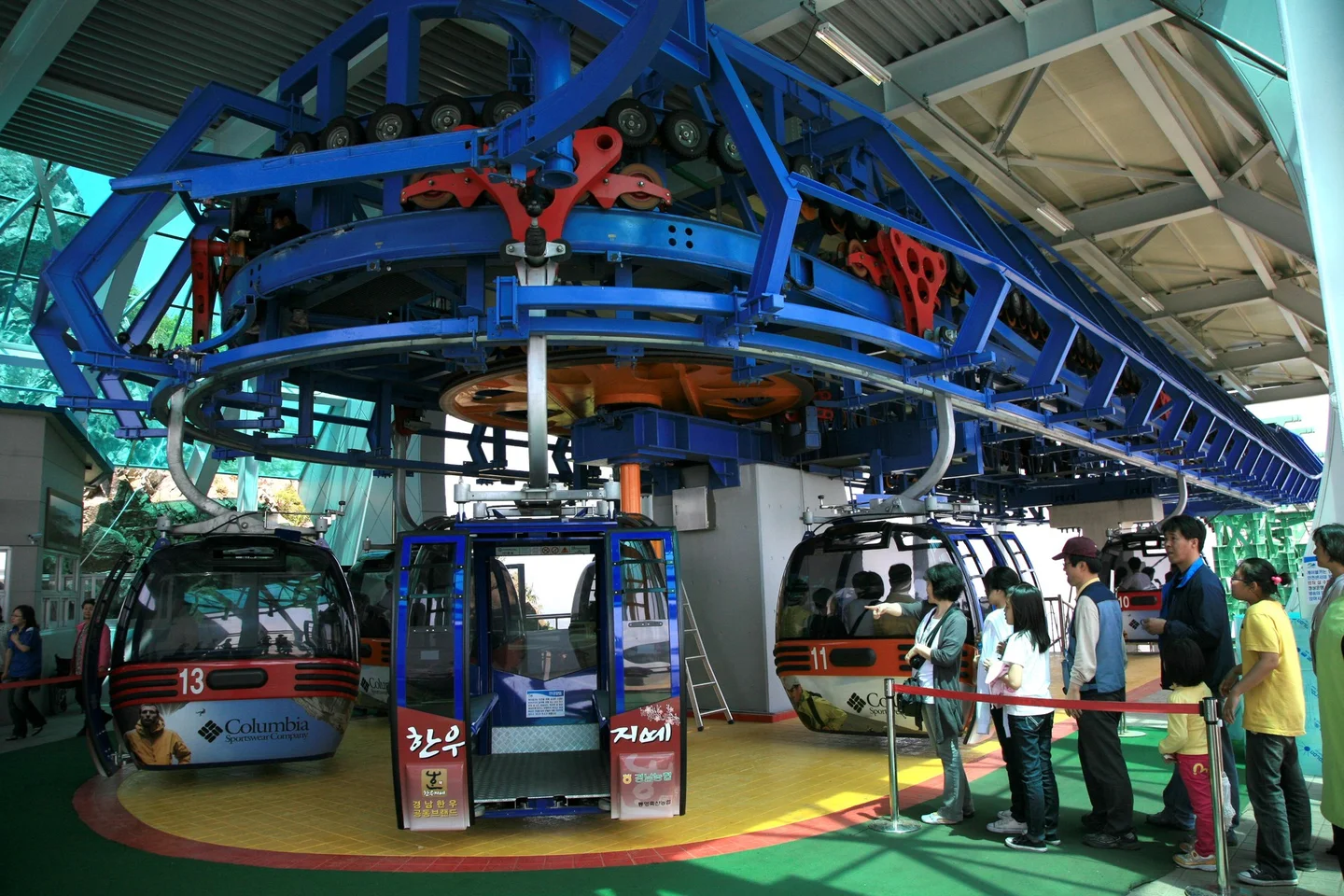
Cable car boarding station where gondolas circulate

by Junho Jung at Flickr from South Korea · Original · CC BY-SA 3.0 ·

Source notices and processing details

Cable car boarding station where gondolas circulate

Photo: by Junho Jung at Flickr from South Korea · commons.wikimedia.org — Korea-Tongyeong-Hallyeo Waterway Observation Cable Car-04.jpg · CC BY-SA 3.0

WebP conversion; proportionally reduced where needed; no cropping or upscaling.

Processed copies are provided under the same license shown above.

CC BY-SA 3.0 https://creativecommons.org/licenses/by-sa/3.0 · 저작자 표시 필수 · 동일조건변경허락(변경 시 같은 라이선스)

360 × 240: Existing supplied proportional WebP rendition; no new crop, resize, upscaling, distortion or synthesis in this connection batch.

720 × 480: Existing supplied proportional WebP rendition; no new crop, resize, upscaling, distortion or synthesis in this connection batch.

1440 × 960: Existing supplied proportional WebP rendition; no new crop, resize, upscaling, distortion or synthesis in this connection batch.

The cable car starts in Donam-dong, away from the old-town market district. Search for Tongyeong Cable Car’s lower station rather than the mountain summit when arranging a ride. From Jungang Market or Gangguan, plan a road transfer across to the Mireukdo side of the city. For travelers arriving at Tongyeong’s intercity bus terminal, the tourism operator’s directions list city bus 141 to the cable-car stop. Confirm the direction and current departure information at the stop. The final approach from the road is uphill, so a taxi to the station area may be easier if walking slopes is difficult. The gondola journey itself takes about nine minutes according to the Korea Tourism Organization. That is the ride time, not the time needed for the whole attraction. Ticketing, boarding lines, walking between viewpoints, and the return journey all need to fit before your next commitment. A round-trip ticket is the straightforward option for a sightseeing visit. A one-way ticket makes sense if you have deliberately planned a mountain route for the other direction. Keep the return ticket until you are back down, and check the final downhill departure when you arrive.

Upper-station views or the summit?
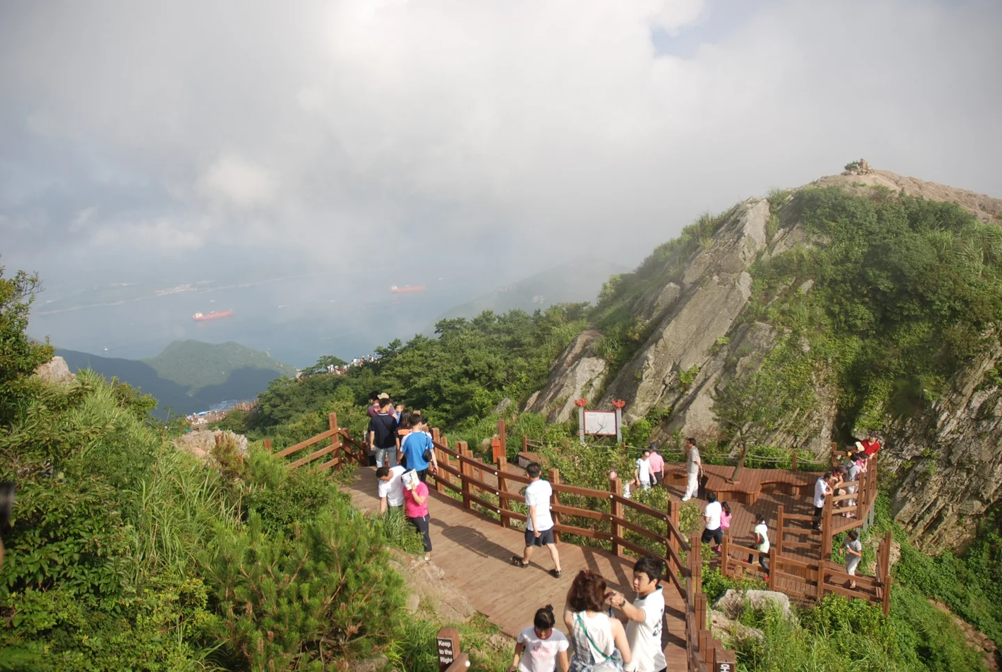
Wooden boardwalk and steps beside a rocky ridge on Mireuksan

Asfreeas · Original · CC BY-SA 3.0 ·

Source notices and processing details

Wooden boardwalk and steps beside a rocky ridge on Mireuksan

Photo: Asfreeas · commons.wikimedia.org — Tongyeong Mt.Miruek Path.jpg · CC BY-SA 3.0

WebP conversion; proportionally reduced where needed; no cropping or upscaling.

Processed copies are provided under the same license shown above.

CC BY-SA 3.0 https://creativecommons.org/licenses/by-sa/3.0 · 저작자 표시 필수 · 동일조건변경허락(변경 시 같은 라이선스)

360 × 242: Existing supplied proportional WebP rendition; no new crop, resize, upscaling, distortion or synthesis in this connection batch.

720 × 483: Existing supplied proportional WebP rendition; no new crop, resize, upscaling, distortion or synthesis in this connection batch.

1440 × 967: Existing supplied proportional WebP rendition; no new crop, resize, upscaling, distortion or synthesis in this connection batch.

Mireuksan’s summit is 461 meters, about 1,510 feet, above sea level. The upper station stops below it. Wooden walkways and stairs continue through the rocky upper slopes, with the summit about a 15-minute walk away at the pace described in KTO’s route guide. Add the same route back, rests, and time at the viewpoints. The climb is short enough to appeal to many occasional walkers, but it still involves stairs. If you want the summit photograph, give yourself time to reach it comfortably rather than treating the walk as a quick step outside the cabin. The exposed rock and changing views along the way are part of the reason to continue. Staying near the upper station is also a good option. Its observation area and glass-floored Skywalk offer sea views without requiring the summit climb. You can enjoy the outlook from solid ground if the transparent floor does not appeal. For wheelchair users, plan the station visit separately from the mountain path. The KTO accessibility guide, updated in September 2026, lists ramps, an elevator between observation levels, and wheelchair routes. It also warns of the steep approach from the bus stop and possible need for assistance. Contact the operator about your chair and boarding arrangements; the summit’s stair route is a different proposition.

Reading the coast from above
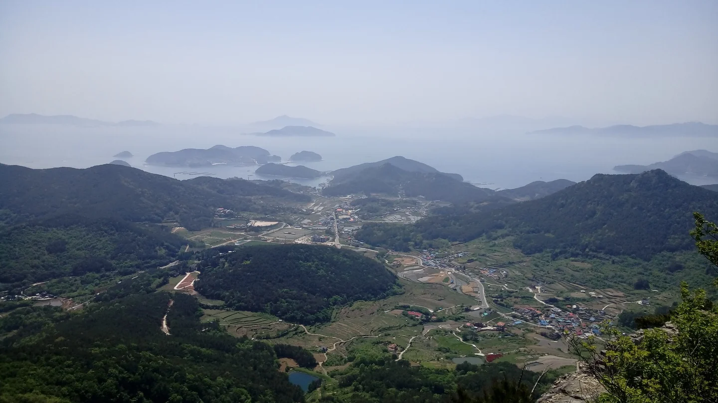
Coastal villages and overlapping islands viewed from Mireuksan

Timur Bilalov · Original · CC BY-SA 3.0 ·

Source notices and processing details

Coastal villages and overlapping islands viewed from Mireuksan

Photo: Timur Bilalov · commons.wikimedia.org — Tongyeong2.jpg · CC BY-SA 3.0

WebP conversion; proportionally reduced where needed; no cropping or upscaling.

Processed copies are provided under the same license shown above.

CC BY-SA 3.0 https://creativecommons.org/licenses/by-sa/3.0 · 저작자 표시 필수 · 동일조건변경허락(변경 시 같은 라이선스)

360 × 202: Existing supplied proportional WebP rendition; no new crop, resize, upscaling, distortion or synthesis in this connection batch.

720 × 404: Existing supplied proportional WebP rendition; no new crop, resize, upscaling, distortion or synthesis in this connection batch.

1440 × 808: Existing supplied proportional WebP rendition; no new crop, resize, upscaling, distortion or synthesis in this connection batch.

Look first at the nearest headlands and the strips of water between them. Then follow the layers of islands farther out. The view is not a single flat line of coast: some channels open toward the sea, while others curl behind ridges and settlements. A map or the on-site panorama signs can help turn the shapes into recognizable places.
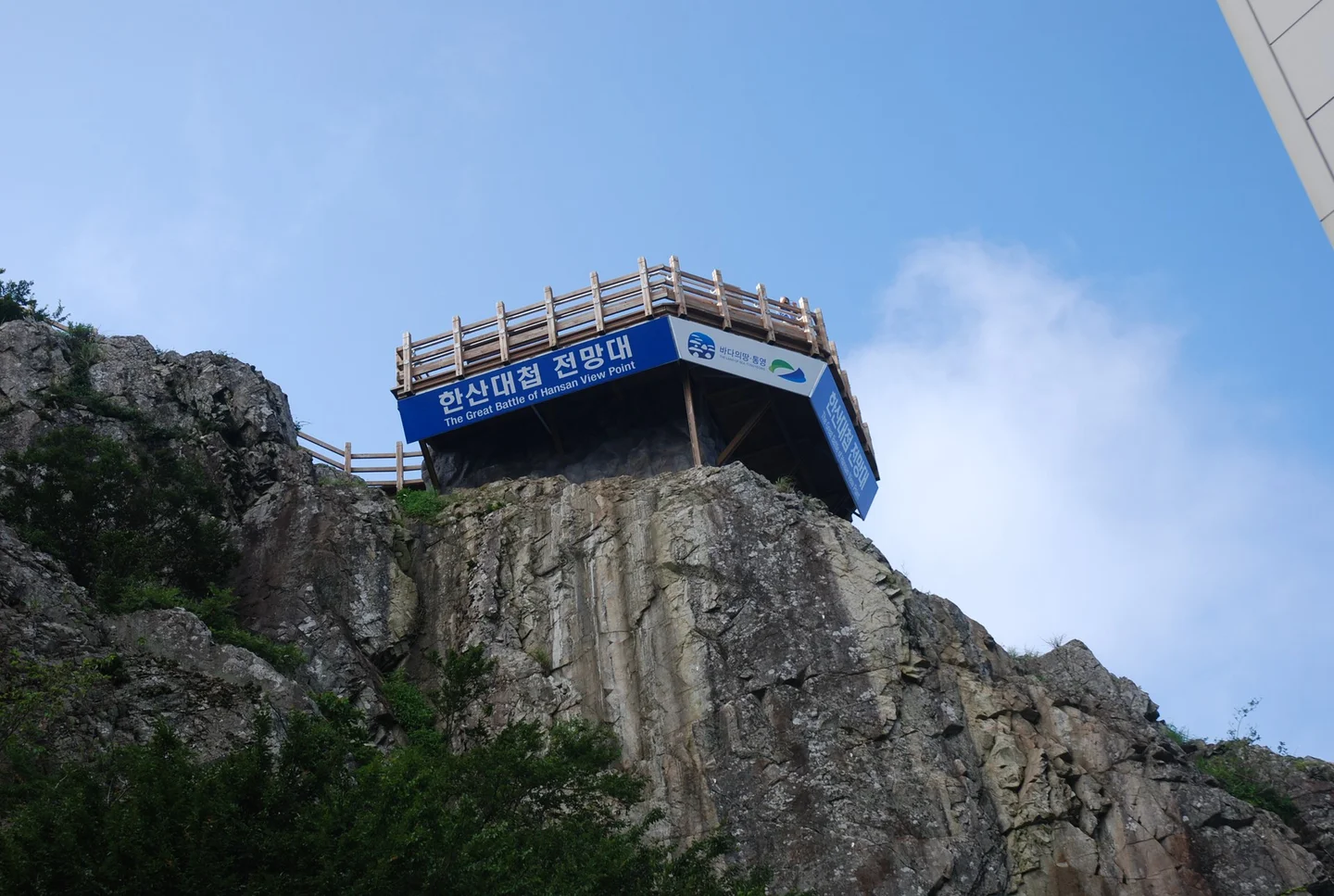
Hansan Battle Observatory built on a rock

Asfreeas · Original · CC BY-SA 3.0 ·

Source notices and processing details

Hansan Battle Observatory built on a rock

Photo: Asfreeas · commons.wikimedia.org — Tongyeong Mt-Miruek Hansan View Piont.jpg · CC BY-SA 3.0

WebP conversion; proportionally reduced where needed; no cropping or upscaling.

Processed copies are provided under the same license shown above.

CC BY-SA 3.0 https://creativecommons.org/licenses/by-sa/3.0 · 저작자 표시 필수 · 동일조건변경허락(변경 시 같은 라이선스)

360 × 242: Existing supplied proportional WebP rendition; no new crop, resize, upscaling, distortion or synthesis in this connection batch.

720 × 483: Existing supplied proportional WebP rendition; no new crop, resize, upscaling, distortion or synthesis in this connection batch.

1440 × 967: Existing supplied proportional WebP rendition; no new crop, resize, upscaling, distortion or synthesis in this connection batch.

One lookout is named for the Battle of Hansan, connecting the landscape with Admiral Yi Sun-sin and the naval history of these waters. The viewpoint is a place to survey that maritime setting. For a closer look at the history, the Tongjeyeong naval headquarters site in town or the heritage sites on Hansando make separate visits. It is worth moving between the designated viewing points. A rocky foreground gives one view a mountain setting; a gap in the trees may open another toward the city or sea. You do not need to keep taking the same wide photograph from the first railing you reach. Visibility matters more than a blue patch of sky at the lower station. Thin haze can soften the islands into overlapping silhouettes, while clearer air reveals more detail in the channels. If distant sea views are your main reason to go, choose the clearest available day of your stay.

Choose the day before fixing the rest of the itinerary

Cable-car operations can change with wind, weather, and maintenance. As checked on October 12, 2026, KTO’s current listing gives the second and fourth Wednesdays of the month as regular closing days. Use the operator’s current notices for the date you intend to visit, and check both ticket-sales cutoff and the final return ride. For a group splitting between the summit and station facilities, agree on a meeting time at the upper station. That makes the return simple and lets the walkers enjoy the trail without leaving the rest of the group uncertain about when they will come back. Dogs are permitted under specific conditions. The operator’s published answer on pet travel specifies dogs weighing less than 10 kilograms, about 22 pounds, in a suitable carrier or pet bag; it also addresses pet strollers. Check the current arrangement before bringing your dog. Assistance-dog access is covered separately in the accessibility guidance. On the upper slopes, wind and exposed steps matter more than elaborate hiking equipment. Bring a light layer if conditions call for one and choose shoes comfortable on stairs. The summit walk should remain optional if rain, fatigue, or a member of the group’s mobility makes it less enjoyable.

Look back toward town before heading down
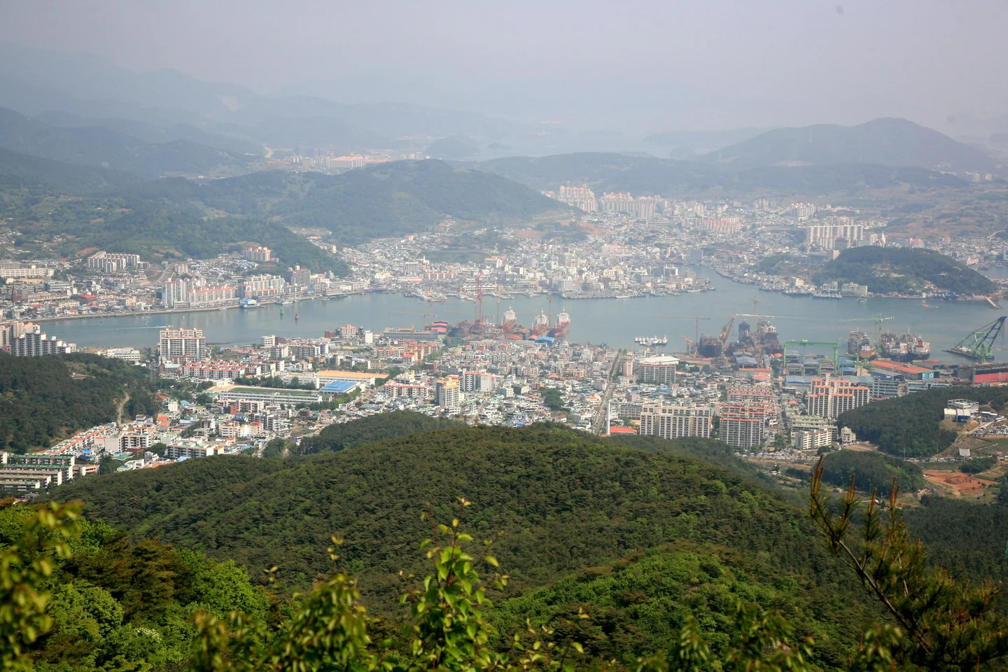
Tongyeong city and harbor viewed from the mountain

by Junho Jung at Flickr from South Korea · Original · CC BY-SA 3.0 ·

Source notices and processing details

Tongyeong city and harbor viewed from the mountain

Photo: by Junho Jung at Flickr from South Korea · commons.wikimedia.org — Korea-Tongyeong-Cityscape-01.jpg · CC BY-SA 3.0

WebP conversion; proportionally reduced where needed; no cropping or upscaling.

Processed copies are provided under the same license shown above.

CC BY-SA 3.0 https://creativecommons.org/licenses/by-sa/3.0 · 저작자 표시 필수 · 동일조건변경허락(변경 시 같은 라이선스)

360 × 240: Existing supplied proportional WebP rendition; no new crop, resize, upscaling, distortion or synthesis in this connection batch.

720 × 480: Existing supplied proportional WebP rendition; no new crop, resize, upscaling, distortion or synthesis in this connection batch.

1440 × 960: Existing supplied proportional WebP rendition; no new crop, resize, upscaling, distortion or synthesis in this connection batch.

The city-facing view is as interesting as the islands. Buildings crowd the shoreline, working waterfronts occupy the flatter ground, and forested hills rise immediately behind them. Looking across Tongyeong from this height helps explain why places that seem close together on a map can involve a winding road journey. After descending, you can stay around Donam-dong for a coastal outing or return to Jungang Market and Gangguan for food and a harbor walk. Keep one area as the next stop rather than moving the car or taking a taxi between every small attraction. The contrast is the pleasure of this combination: forest beneath the gondola, islands from the mountain, then the harbor at street level. Give the high viewpoint enough time, and the town below becomes more interesting when you return to it.

SourcesKTO generalcablecarguide directlyread:9min gondolaride; noinstantboardingorlatesttechnologyclaimcopied: https://korean.visitkorea.or.kr/detail/ms_detail.do?cotid=0c8fdbdf-39d2-4e46-8403-e05d9c1bd168 KTO2023routeguide directlyread:461m summit,15minwalkfromupper,woodenstairs/Skywalk; olderhours/pet10kginclusive notused: https://korean.visitkorea.or.kr/detail/rem_detail.do?cotid=93f52741-d8d6-4258-9183-96b895e8a189 KTOaccessibilityguide fullrenderdirectread updated2026Sep10:2nd4thWednesdayclosure,ramps/elevator,steepbusapproachassistance,assistance dogs. Currentguideprioritized overolderMondayrule: https://access.visitkorea.or.kr/ms/detail.do?cotId=59bb8349-458c-4321-a6b7-576d153e3e26 KTOaccessiblefieldroute directlyread forboardingassistance andupperstationelevator/Skywalk;datedfacilitydetailsnotuniversalchairfitpromise: https://access.visitkorea.or.kr/cos/detail.do?cotId=9bea15e9-d29d-4977-a4b2-c06a3a3c0ab2 Operatorcurrentdirectionsdirectlyread route141terminaltocablecar;oldtaxipricenotused: https://corp.ttdc.kr/about/location.aspx Operator2024Oct17replydirectlyread dogsstrictlyunder10kg/carrierbag/petstroller;notallpetsallweights: https://corp.ttdc.kr/board/board.aspx?mode=view&seq=18960&tbl=customer Operatornoticesdirectlyrendered2026Oct6latest;maintenance/weathercheckresource. Dedicatedcablecarsite403notclaimedread: https://corp.ttdc.kr/board/board.aspx?tbl=notice 확인일: 2026-10-12 (Asia/Seoul). 기본 근거: gyeongnam-ulsan-002 한국어 완료 원고의 사실·선택 사진. 영어는 독립 구성·집필.

Travel guide