Daebudo Day Trip: Clam Noodles, Tidal Walks, and West-Coast Sunsets
낭만고래 · Original · CC BY-SA 4.0 ·
Daebudo's coast changes dramatically over the course of a day. Water that reaches the shore at high tide gives way to broad mudflats, winding channels, and a path toward an offshore island. Later, low sunlight catches the remaining pools and silhouettes the wind turbines. This is a rewarding trip from the Seoul area for travelers who enjoy coastal walking and a seafood meal, with the tide helping decide what happens when. Choose a part of the coast before planning individual stops. Bangameori and the Gubongdo area suit a northern outing with beach time and restaurants. Tando Port and Nue Island, farther south, are the better focus for a tidal crossing. They are separate areas requiring travel between them, rather than stops along one continuous seaside promenade.
User:Piotrus · Original · CC BY-SA 4.0 ·
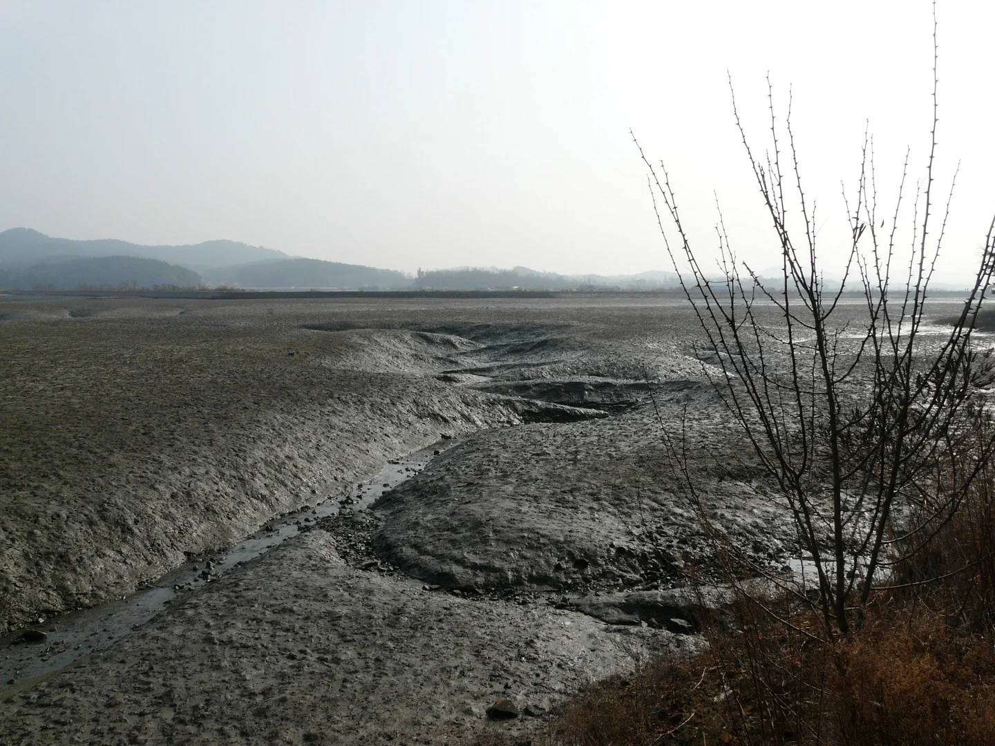
Low tide is an attraction in its own right. Channels cut branching patterns through the exposed mud, birds gather near the water, and rocks that were submerged become visible. You can appreciate much of this from the shore. Walking out across the flats or collecting shellfish is a different activity, best arranged through an operating fishing-village experience program with a defined area and suitable timing.
Bangameori for the Beach and a Bowl of Clam Noodles
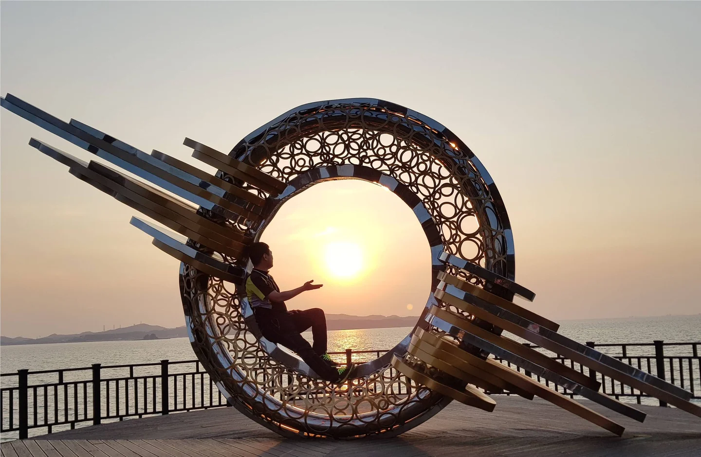
Bangameori is a useful first stop when entering Daebudo from the Sihwa Seawall. The beach and nearby restaurant area make a straightforward combination if you want a relaxed outing without a long coastal hike. Park or arrive at a specific beach access point, then explore that immediate area before deciding on another drive. The signature meal is bajirak kalguksu: knife-cut wheat noodles in a clam broth. The city's food guide traces its local popularity to the clams gathered around Daebudo and the growth of road access to the island. It makes a warming lunch after a breezy shoreline walk, and introduces a local specialty without requiring a large seafood feast. The Bangameori food street also has restaurants serving raw fish and grilled shellfish. Decide whether you want noodles or a shared seafood meal, then compare menus with that choice in mind. Check whether a displayed price is per person or per platter, and whether any added seafood changes the total. Travelers avoiding shellfish should confirm the broth as well as the visible toppings. Gubongdo's coastal scenery is a possible northern extension, but its famous sunset platform needs a current access check. As reviewed October 12, 2026, the city's repair notice announces closure of Gubongdo Sunset Observatory from March 12 until further notice. Do not plan on reaching the circular sculpture unless reopening is confirmed. Choose an open shoreline section or stay around Bangameori if that platform was your main reason for the detour. The broader Daebu Haesol-gil walking network includes coastal and wooded routes. Pick a clearly marked section with a known return point; a route toward a viewpoint can involve steps and rougher ground than the beach-front area. Current barriers and trail notices take precedence over an older walking itinerary.
Tando Port to Nue Island: A Walk Timed by the Tide
User:Piotrus · Original · CC BY-SA 4.0 ·
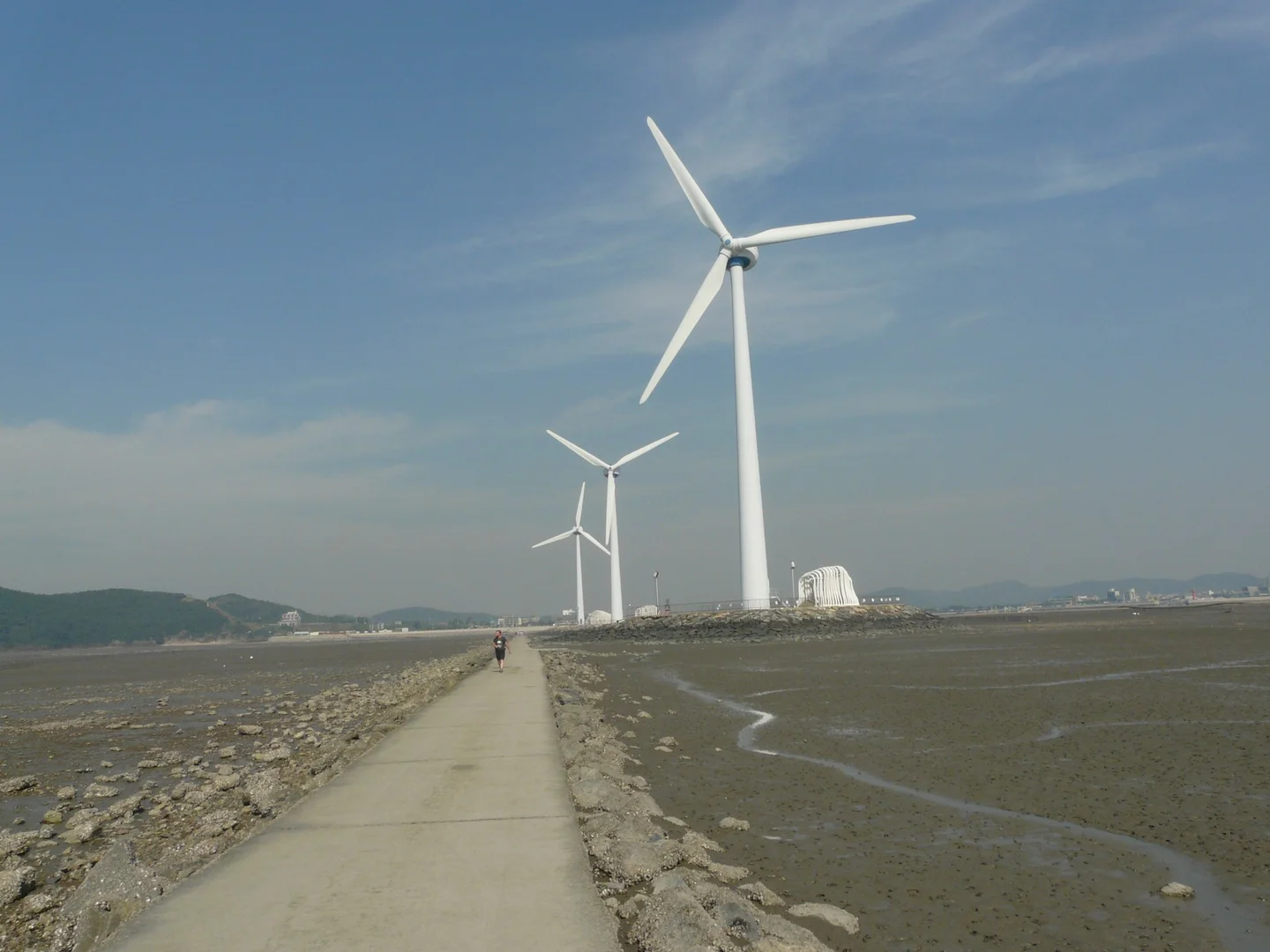
At Tando Port, the receding tide exposes a causeway toward Nue Island, with tall wind turbines marking the offshore landscape. The city's route description gives the crossing as about 1.2 kilometers each way. Include the return distance and time on the island when deciding whether there is enough time to go out. The experience is the walk itself: mudflats stretch on either side, the turbines grow larger as you approach, and the mainland gradually recedes behind you. Stay on the designated route. The surrounding flats are not a shortcut, and water channels can separate areas that appear connected from a distance. Check the date's tide information and the posted access period at the entrance before setting off. A low-tide time identifies the point when water is lowest; it does not, by itself, give the beginning and end of a safe crossing window. Follow the local closure time and staff directions, allowing enough margin to be back on the mainland before the path is covered. If that margin isn't available, enjoy the view from Tando Port instead.
User:Piotrus · Original · CC BY-SA 4.0 ·
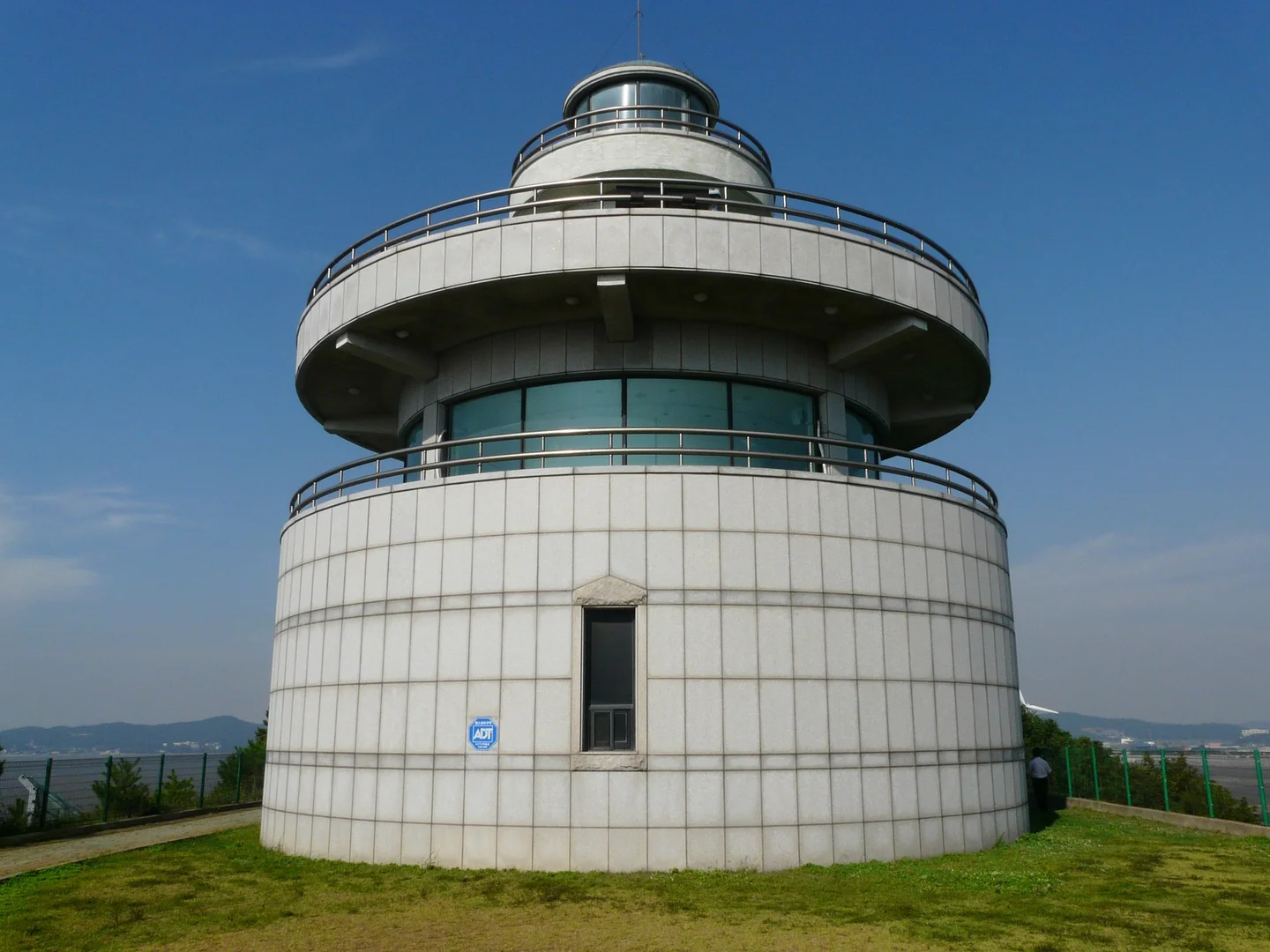
Nue Island's lighthouse observatory adds a higher perspective over the sea, nearby islands, and the route back to Tando. The building's opening and the causeway's access are separate matters. Confirm both if going inside is important, and give the return crossing priority over an extra few minutes at the lookout.
Watching Sunset from Tando
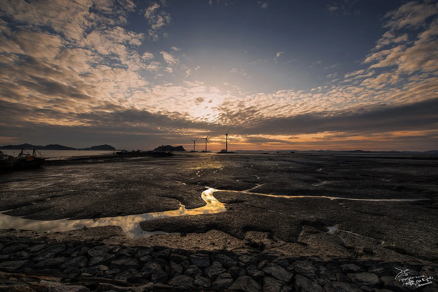
You do not need to cross to the island to enjoy Tando's sunset. From permitted viewing areas around the port, the turbines form a recognizable silhouette and shallow channels can reflect the evening sky. At higher tide, the emphasis shifts to the water and distant landforms; at lower tide, the texture of the flats becomes part of the scene. Sunset and the safe causeway window will not always coincide. Decide which matters more to your visit instead of staying offshore to wait for the light. If the crossing is an earlier activity, return to the port and take a break before the evening view. If the causeway never fits your schedule, a shore-based sunset visit still gives you the characteristic Tando landscape. Choose your viewing spot while it is light enough to see the route back. For travelers without a car, the last practical bus connection may determine when to leave, so check that before settling in for dusk.
Add Daebu Mine for a Different Kind of Landscape
Jjw · Original · CC BY-SA 4.0 ·
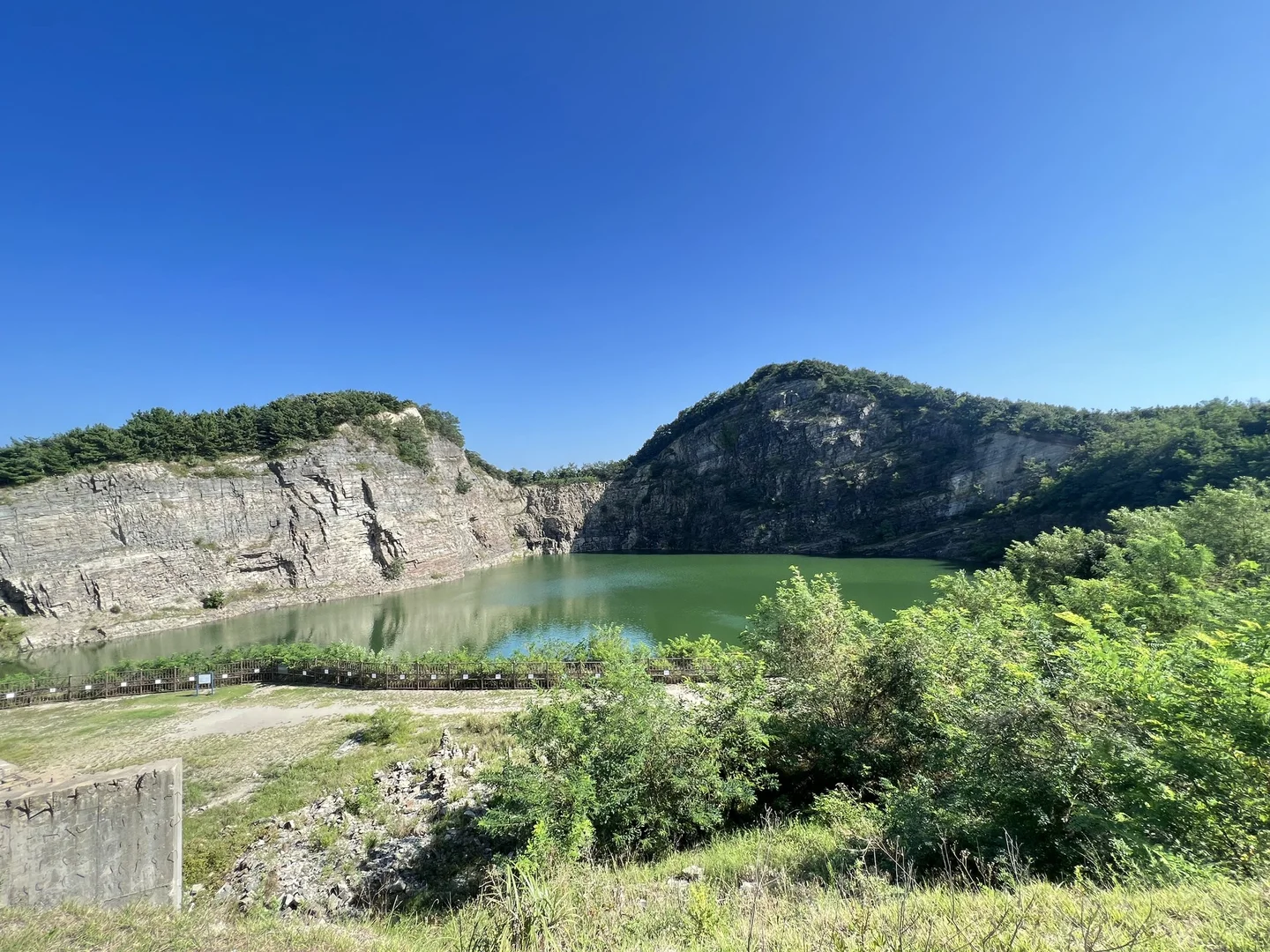
Near the Tando and Seongamdo area, the Daebu Mine sedimentary rock formations offer a striking change from the tidal coast. A former quarry exposes tall, layered rock faces above a lake. The city's heritage description explains the site's Late Cretaceous geology and the discovery of dinosaur footprints and plant fossils. The visible layers are the main reason to come. Compare their thickness, color, and direction across the cut face, then look at how the quarrying exposed them. This is an outdoor geological landscape, rather than an underground mine tour. Use the open viewing paths and keep away from restricted cliff edges and the water. This stop is easier to move earlier or later in the day than the Nue Island crossing, making it a useful addition when you have a car and spare time around the tide. If the quarry is your main destination, confirm the currently open viewing area before setting out, since works or events can affect access.
Getting Around Without Overloading the Day
Daebudo's attractions are spread across a road-connected coastal area. Enter the actual destination, such as Bangameori Beach or Tando Port, when checking transport rather than using “Daebudo” alone. The city's transport page links to current regional bus information. Compare the final stop, any onward walk, and the return service, especially for a sunset trip. A car makes it easier to combine the northern and southern areas, but it doesn't remove the tide constraint or the possibility of weekend road delays. Keep a timed crossing as the fixed part of the day, with lunch and the quarry visit placed around it. For a shorter public-transport outing, one coastal area and a meal will leave more time at the shore than repeated transfers between distant stops.