gil.KOREA

Namsan and N Seoul Tower: Getting Up the Mountain and Making the Most of the View
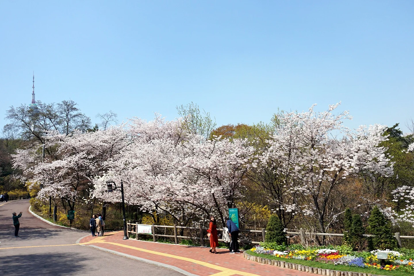
Cherry blossoms along a Namsan Park path with the tower in the distance

Matt Kieffer from London, United Kingdom · Original · CC BY-SA 2.0 ·

Source notices and processing details

Cherry blossoms along a Namsan Park path with the tower in the distance

Photo: Matt Kieffer from London, United Kingdom · Wikimedia Commons — Namsan Mountain and Seoul Tower (49175169342).jpg · CC BY-SA 2.0

WebP conversion; proportionally reduced where needed; no cropping or upscaling.

Processed copies are provided under the same license shown above.

CC BY-SA 2.0. 저작자 표시와 동일조건 공유 필요. WebP는 축소 파생물이며 CC BY-SA 2.0 유지.

360 × 240: EXIF orientation normalized=False; RGB source without embedded ICC; color profile not invented; proportional downsample to 360x240; WebP q85; no crop, no synthesis

720 × 480: EXIF orientation normalized=False; RGB source without embedded ICC; color profile not invented; proportional downsample to 720x480; WebP q85; no crop, no synthesis

1440 × 961: EXIF orientation normalized=False; RGB source without embedded ICC; color profile not invented; proportional downsample to 1440x961; WebP q85; no crop, no synthesis

Namsan gives Seoul room to spread out below you. Trees replace storefronts as you climb, the city's hills become easier to read, and N Seoul Tower turns from a distant landmark into the center of the skyline above your head. The appeal is both the panorama and the park around it. You can make a worthwhile visit without buying an observatory ticket. The mountain suits different kinds of outings: a daytime walk along the city wall, a cable car ride followed by a look around the summit, or an evening watching roads and bridges light up. Spring blossoms and fall foliage add seasonal interest, but clear visibility and a route that fits your energy matter more than matching a particular photograph. The main planning decision is how to go up and come down. A subway station at the foot of Namsan isn't the end of the journey, and a short distance on a map can include a substantial climb. Choose the transport first, then decide how much walking and tower time you want to add.

Bus or cable car?
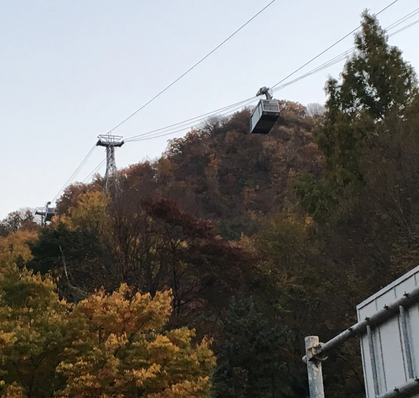
Cable car passing above the forest on Namsan

Scott Edmunds · Original · CC BY 2.0 ·

Source notices and processing details

Cable car passing above the forest on Namsan

Photo: Scott Edmunds · Wikimedia Commons — Cable car up the Seoul Tower (33580430468).jpg · CC BY 2.0

WebP conversion; proportionally reduced where needed; no cropping or upscaling.

CC BY 2.0. 상업적 이용과 변경 가능. 출처 표시. 촬영 2017-11-03. 남산 케이블카. 타워 전망 사진이 아니고 백범광장 성곽 사진도 아님.

360 × 342: EXIF orientation normalized=False; embedded ICC transformed to sRGB; proportional downsample to 360x342; WebP q85; no crop, no synthesis

720 × 684: EXIF orientation normalized=False; embedded ICC transformed to sRGB; proportional downsample to 720x684; WebP q85; no crop, no synthesis

1440 × 1369: EXIF orientation normalized=False; embedded ICC transformed to sRGB; proportional downsample to 1440x1369; WebP q85; no crop, no synthesis

The Namsan circular bus is a practical option if you'd rather save your energy for the top. N Seoul Tower's official transport guide lists routes 01A and 01B, with connections at Chungmuro Station on Lines 3 and 4 and Dongguk University Station on Line 3. At Chungmuro, look for the Namsan-bound stop by Exit 2. The station exit and the boarding point are separate things to find. These are circulating routes, so the downhill trip doesn't necessarily retrace the uphill journey. Look at the stops after the tower and choose where to get off for your next destination. A transit card with enough balance makes boarding straightforward. Routes were checked on October 12, 2026; use the operator's current map when planning the actual trip. The cable car is the choice when the ride itself is part of the fun. Approach the lower station from the Myeongdong side, then rise over the wooded slope with views of the surrounding city. Allow time to reach the station and wait to board. Arriving at Myeongdong Station doesn't put you immediately on the cable car. A cable car ticket and an N Seoul Tower observatory ticket cover different experiences. Check what any package includes, and decide whether you need a one-way or round-trip ride. Weather can affect cable car operation. Ordinary private cars are restricted from the summit approach, so a typical sightseeing plan should use the bus, cable car or walking routes rather than assume a taxi can drop you at the tower door.

Walking up: choose a summit route or a park route
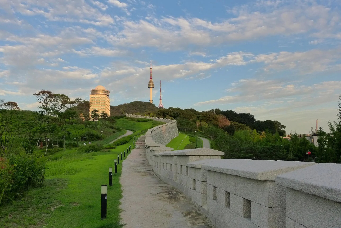
City wall path on the slopes of Namsan and N Seoul Tower

travel oriented from Manila, Philippines · Original · CC BY-SA 2.0 ·

Source notices and processing details

City wall path on the slopes of Namsan and N Seoul Tower

Photo: travel oriented from Manila, Philippines · Wikimedia Commons — Seoul Tower from Namsan Park (9595148285).jpg · CC BY-SA 2.0

WebP conversion; proportionally reduced where needed; no cropping or upscaling.

Processed copies are provided under the same license shown above.

CC BY-SA 2.0. 저작자 표시와 동일조건 공유 필요. WebP는 축소 파생물이며 CC BY-SA 2.0 유지.

360 × 240: EXIF orientation normalized=False; embedded ICC transformed to sRGB; proportional downsample to 360x240; WebP q85; no crop, no synthesis

720 × 480: EXIF orientation normalized=False; embedded ICC transformed to sRGB; proportional downsample to 720x480; WebP q85; no crop, no synthesis

1440 × 961: EXIF orientation normalized=False; embedded ICC transformed to sRGB; proportional downsample to 1440x961; WebP q85; no crop, no synthesis

Namsan Park is a broad destination, not a single trail. From the Hoehyeon side, Baekbeom Square and the city wall provide an attractive approach, with stonework following the hill and the tower rising farther ahead. Paths on other sides of the mountain begin at different elevations and involve different amounts of climbing. The Namsan Dulle-gil loops around the mountain; it isn't simply another name for the route to the summit. Choose the perimeter paths for a woodland walk, or follow a mapped summit approach if your goal is the pavilion and tower. A shorter wall-side walk can be satisfying in its own right without continuing all the way up. Slopes and stairs matter more here than the distance alone. The descent can also be tiring after a full day in the city. Combining a walk in one direction with transport in the other is a useful compromise. For a wheelchair or stroller, check the actual route's gradients and steps rather than accepting the shortest walking suggestion. In icy conditions, shorten the walk and use the available transport instead.

Around the summit: a pavilion, city views and small discoveries
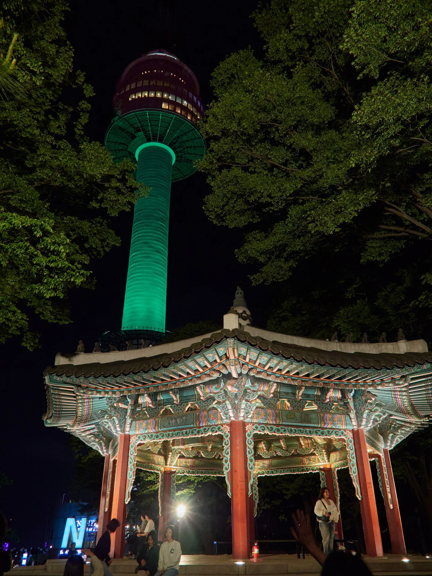
Namsan Octagonal Pavilion and N Seoul Tower at night

lumoplank · Original · CC0 1.0 ·

Source notices and processing details

Namsan Octagonal Pavilion and N Seoul Tower at night

Photo: lumoplank · Wikimedia Commons — Namsan Tower, Seoul - Namsan2299.jpg · CC0 1.0

WebP conversion; proportionally reduced where needed; no cropping or upscaling.

CC0 1.0. 상업적 이용·수정 가능. 촬영자 lumoplank. WebP는 축소 파생물.

360 × 480: EXIF orientation normalized=False; embedded ICC transformed to sRGB; proportional downsample to 360x480; WebP q85; no crop, no synthesis

720 × 960: EXIF orientation normalized=False; embedded ICC transformed to sRGB; proportional downsample to 720x960; WebP q85; no crop, no synthesis

1440 × 1920: EXIF orientation normalized=False; embedded ICC transformed to sRGB; proportional downsample to 1440x1920; WebP q85; no crop, no synthesis

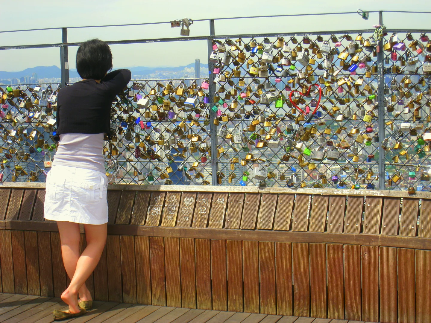
Near the tower, Palgakjeong's traditional pavilion roof creates a distinctive foreground to the tall modern structure. Explore the outdoor spaces before deciding whether to go farther up inside the tower. Different sides open toward different parts of Seoul, and a small change of position can alter what you see between the trees and buildings. The pavilion also makes a recognizable meeting point when a group splits up. If some people want the observatory and others prefer to stay outside, agree where to meet before joining a line. Add food or souvenir shopping only after allowing for your ride down. The love-lock area
Railing covered with colorful padlocks

Daderot · Original · Public domain — source notice ·

Source notices and processing details

Railing covered with colorful padlocks

Photo: Daderot · Wikimedia Commons — Locks atop Namsan - Seoul, Korea.jpg · Public domain — source notice

WebP conversion; proportionally reduced where needed; no cropping or upscaling.

Public domain (Wikimedia Commons). 촬영자 Daderot. 남산 정상의 자물쇠 벽과 서울 전경. 원본 JPEG와 WebP 파생본. 출처 페이지의 라이선스 표시를 확인함.

360 × 270: EXIF orientation normalized=True; RGB source without embedded ICC; color profile not invented; proportional downsample to 360x270; WebP q85; no crop, no synthesis

720 × 540: EXIF orientation normalized=True; RGB source without embedded ICC; color profile not invented; proportional downsample to 720x540; WebP q85; no crop, no synthesis

1440 × 1080: EXIF orientation normalized=True; RGB source without embedded ICC; color profile not invented; proportional downsample to 1440x1080; WebP q85; no crop, no synthesis

The colorful love locks are one of the summit's familiar sights. Some visitors come to leave a memento; others simply enjoy the displays and the city beyond them. If you choose to add a lock, use the designated places and keep the key and packaging out of the wooded slopes below. The earlier way to send a signal
Stone reconstruction of Mokmyeoksan Beacon Mound

Wei-Te Wong · Original · CC BY-SA 2.0 ·

Source notices and processing details

Stone reconstruction of Mokmyeoksan Beacon Mound

Photo: Wei-Te Wong · Wikimedia Commons — Wongwt 南山烽火台 (16940987478).jpg · CC BY-SA 2.0

WebP conversion; proportionally reduced where needed; no cropping or upscaling.

Processed copies are provided under the same license shown above.

CC BY-SA 2.0 · 출처·동일조건 유지

360 × 240: EXIF orientation normalized=False; embedded ICC transformed to sRGB; proportional downsample to 360x240; WebP q85; no crop, no synthesis

720 × 480: EXIF orientation normalized=False; embedded ICC transformed to sRGB; proportional downsample to 720x480; WebP q85; no crop, no synthesis

1440 × 960: EXIF orientation normalized=False; embedded ICC transformed to sRGB; proportional downsample to 1440x960; WebP q85; no crop, no synthesis

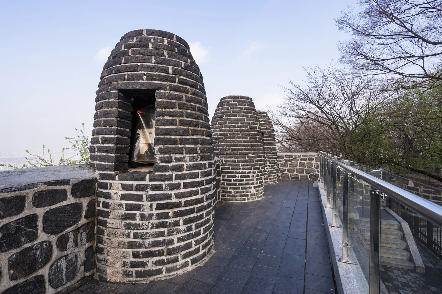
The Mongmyeoksan beacon station recalls a much older use for this high point. Smoke and fire carried messages across a network of beacon sites. The structures visible today are reconstructed, not a complete set of untouched originals. It's a brief stop with a clear idea behind it: long before the modern tower, elevation made Namsan useful for communication. That connection adds a little history to a summit visit otherwise dominated by the view.

Is the observatory worth adding?
Night view of the Han River and Seoul from above

kallerna · Original · CC BY-SA 4.0 ·

Source notices and processing details

Night view of the Han River and Seoul from above

Photo: kallerna · Wikimedia Commons — N Seoul Tower view 2.jpg · CC BY-SA 4.0

WebP conversion; proportionally reduced where needed; no cropping or upscaling.

Processed copies are provided under the same license shown above.

CC BY-SA 4.0. 촬영자 kallerna. 상업적 이용·수정 가능. 원본과 WebP 파생물 모두 동일 라이선스(CC BY-SA 4.0)로 공유해야 함(ShareAlike). N서울타워에서 본 서울 야경. 출처 Wikimedia Commons.

360 × 196: EXIF orientation normalized=False; embedded ICC transformed to sRGB; proportional downsample to 360x196; WebP q85; no crop, no synthesis

720 × 391: EXIF orientation normalized=False; embedded ICC transformed to sRGB; proportional downsample to 720x391; WebP q85; no crop, no synthesis

1440 × 783: EXIF orientation normalized=False; embedded ICC transformed to sRGB; proportional downsample to 1440x783; WebP q85; no crop, no synthesis

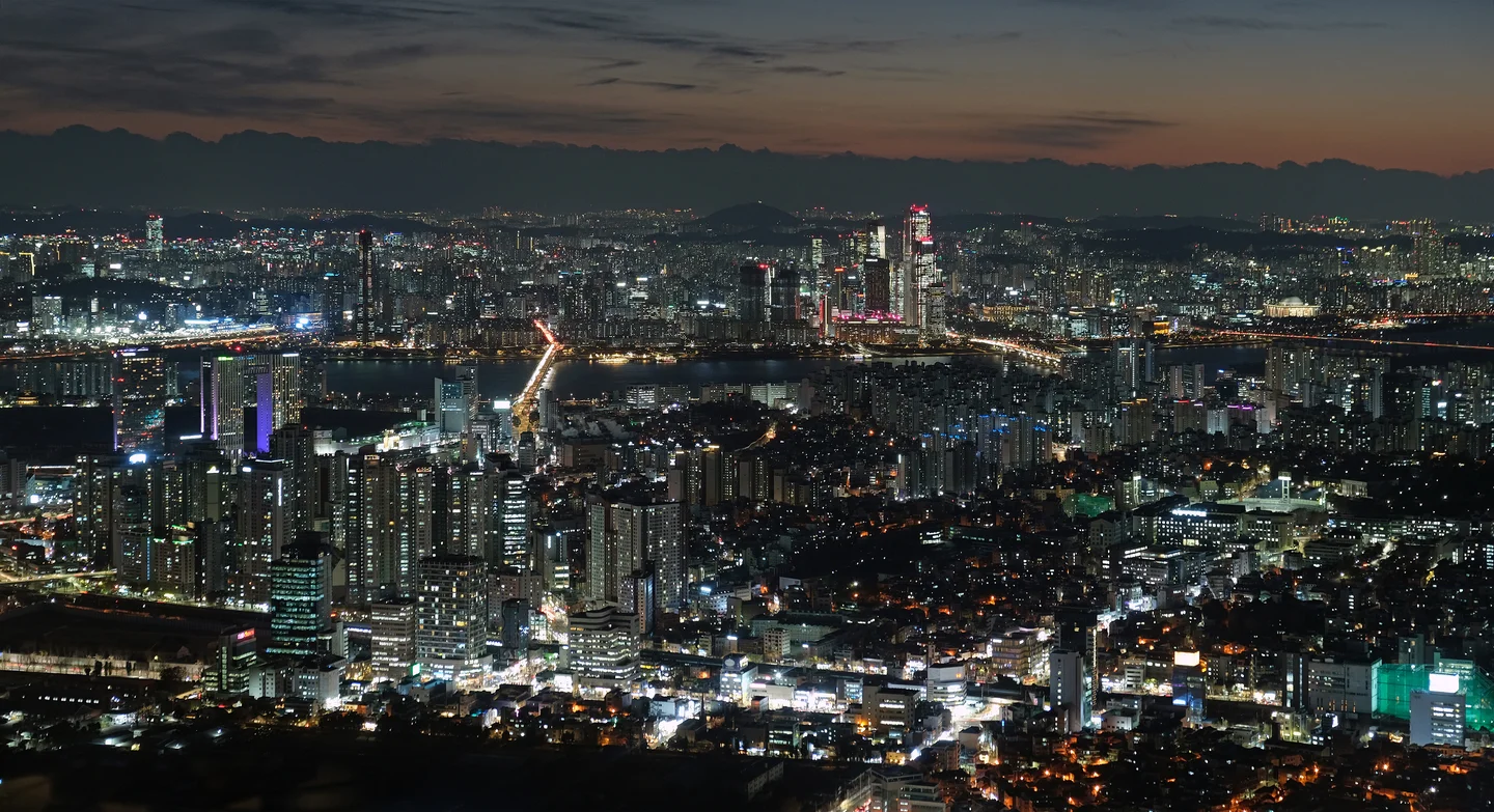
The observatory takes you higher than the outdoor summit areas, giving you a broader perspective on the Han River, road networks and dense neighborhoods. It makes sense if the panorama is the main reason you came and visibility is good. If your priority is a park walk, the outdoor viewpoints may already give you the experience you wanted. Check the view conditions, not just the chance of rain. Haze and fog can soften distant buildings even on a dry day. For sunset and night scenery, arrive early enough to watch daylight fade, using the actual sunset time for your date rather than a fixed hour throughout the year. Through the observatory glass, reflected lights can compete with the city below. Avoid flash and try a position with fewer reflections; outside, a wind-resistant layer makes waiting more comfortable. The time spent looking at Seoul is only part of the outing, so leave room for the line and journey down. The tower and cable car have separate ticketing, closing times and operating notices. A clear plan for getting back lets you enjoy the summit without turning the final part of the evening into an unplanned forest descent. The best version of Namsan is the one that balances the walk, the ride and the view in proportions that suit your day.

SourcesN서울타워 교통안내: https://www.nseoultower.co.kr/visit/traffic.asp YTN서울타워 교통카드·노선도: https://seoulytn.ytn.co.kr/visit/transfers N서울타워 이용시간: https://www.nseoultower.co.kr/visit/use.asp N서울타워 이용요금: https://www.nseoultower.co.kr/visit/use2.asp 남산케이블카 운영사: https://www.namsancablecar.com/ 서울시 공원 자주하는 질문·일반차량 제한: https://parks.seoul.go.kr/content.do?key=2604070012 서울한양도성 남산구간 안내·지도: https://seoulcitywall.seoul.go.kr/wallcourse/4.do 국가유산청 목멱산봉수대터: https://digital.khs.go.kr/heri/heriDetail.do?ctptNo=2331100140000&ctptUid=13898859704671503321 확인일: 2026-10-12 (Asia/Seoul). 기본 근거: seoul-007 한국어 완료 원고의 사실·선택 사진. 영어는 독립 구성·집필.

Travel guide