Inwangsan: A Rocky Skyline Hike Above Seochon
golbenge (골뱅이) · Original · CC BY-SA 2.0 ·
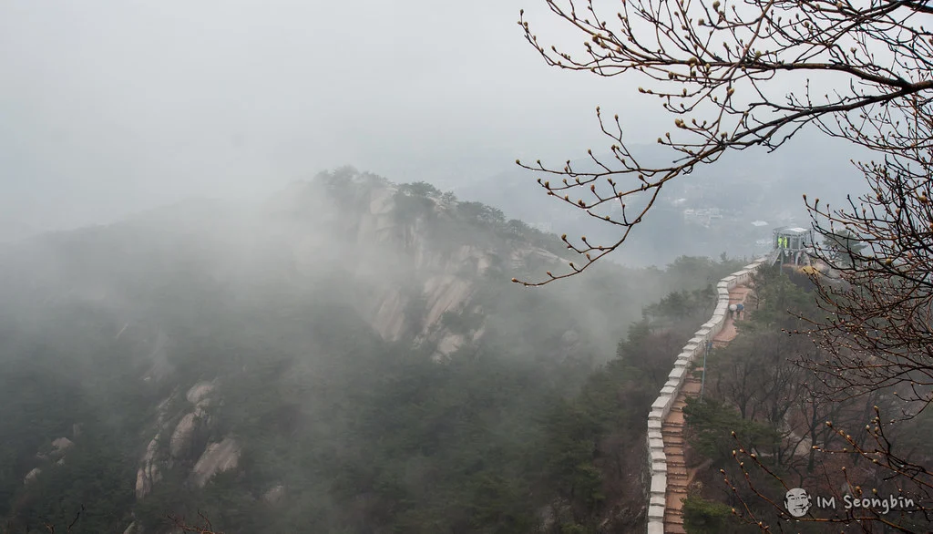
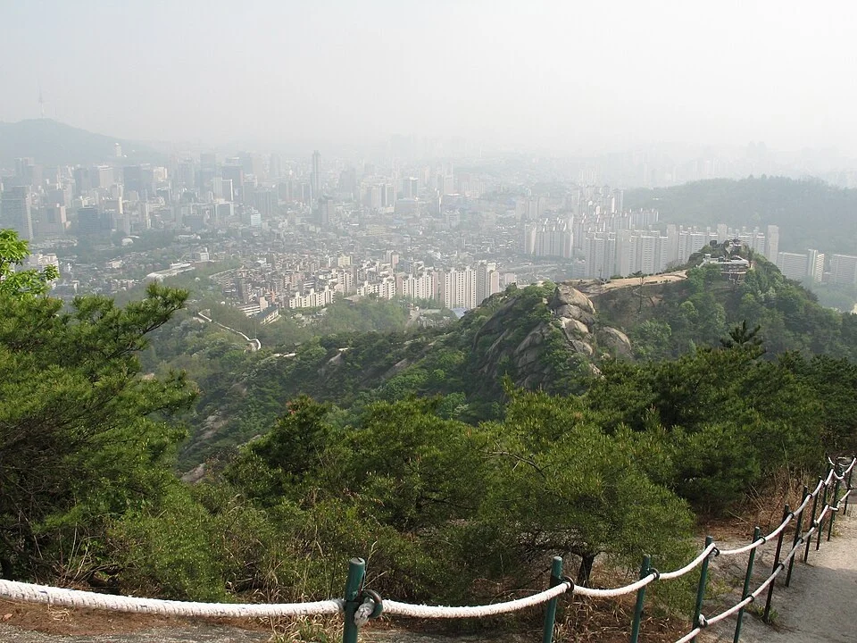
The city wall curls across exposed granite, pine trees grip the rock, and central Seoul spreads out below. Inwangsan gives you a particularly direct encounter with the capital’s mountain setting: the climb is close to Gyeongbokgung and Seochon, yet the upper ridge feels open, rugged, and distinctly above the streets. This landscape has held people’s attention for centuries. In 1751, Jeong Seon painted its dark rock faces emerging from mist in Clearing after Rain on Mount Inwang. Looking at the National Museum of Korea’s account of the painting before a visit gives the mountain another dimension. You can recognize the drama of its broad granite surfaces without needing to reproduce the painter’s viewpoint or wait for rainy weather. For a traveler with half a day, the combination is compelling: climb beside a historic wall, look over the palace district and downtown, then descend for lunch in a neighborhood you might already want to explore. The important choice is whether you want the upper ridge or a gentler foothill outing. Inwangsan is compact, but the summit route includes steep stairs and rock underfoot.
A Mountain With Several Very Different Entrances
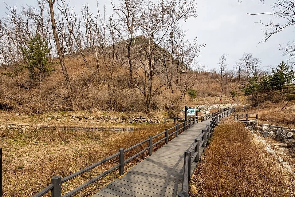
For the wall-and-summit experience, a practical southern approach begins at Gyeongbokgung Station, Exit 1, through the Sajik Park and Jongno Culture and Sports Center area. Save the trail entrance rather than only an “Inwangsan” pin. The walk from the subway through the neighborhood is part of the outing, before the mountain climb begins. A longer historical approach starts at the former Donuimun gate site. Seoul’s official Inwang section runs from there across the mountain to Changuimun: 4 kilometers, with an estimated walking time of 2½ hours. This is a route definition, not a promise that every visitor will finish the subway-to-lunch trip in that time. The city-wall map shows the urban connecting stretches as well as the ridge. From the north, Yun Dong-ju’s Hill near Changuimun provides another approach. This direction can work well if you want to finish in Seochon. Starting from the south and continuing north instead leaves you near Buam-dong. Choose the ending that suits your afternoon rather than assuming you must return to the first entrance. Muak Park is a separate option on the western foothills, with planted areas and wooden walkways. It is useful for a smaller-scale outdoor break, but it is not Suseongdong Valley on the Seochon side, and a comfortable stretch of boardwalk does not describe the climb above it. Share the exact park name with your companions before setting out.
Follow the Wall Toward the City Views
dbaron · Original · CC BY-SA 2.0 ·
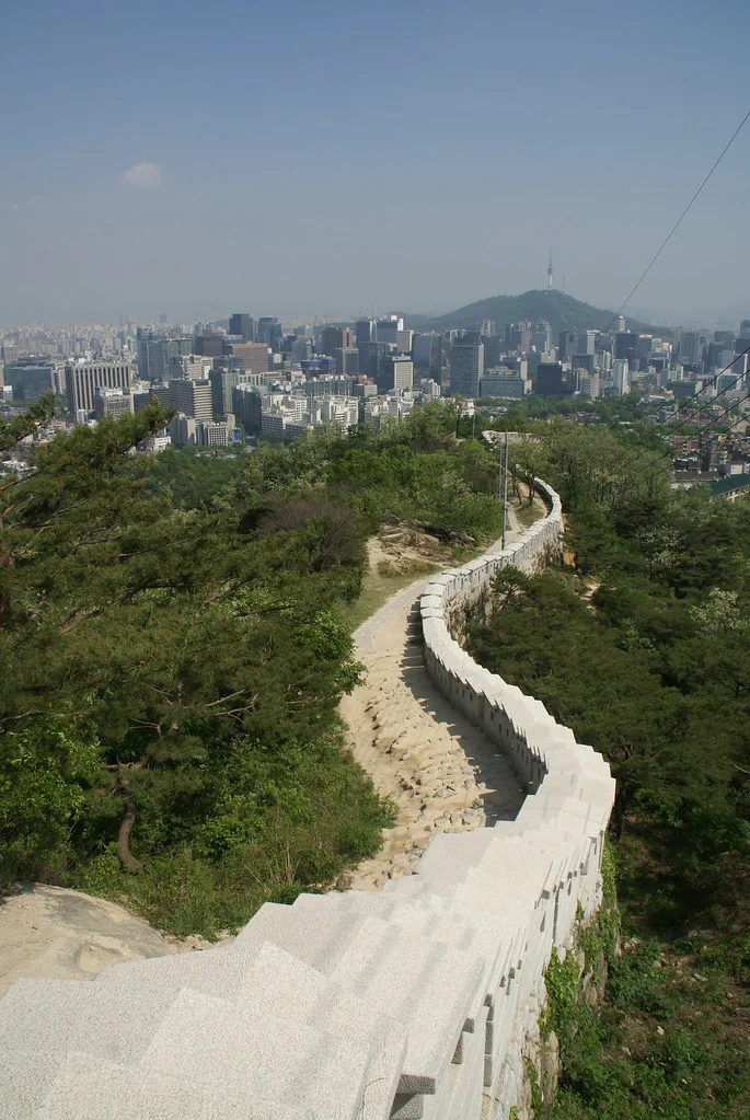
The wall supplies a striking line through the landscape. In places it curves down toward the buildings; elsewhere it rises ahead of you across the mountain. Walking alongside it lets you see both the stonework at close range and the larger defensive shape drawn across the ridge. When the view opens, look toward Namsan and its tower, then across the clusters of office buildings and lower residential streets. From suitable viewpoints, the palace district is also part of the panorama. It is a satisfying place to connect destinations you have already visited at street level: distances and directions that felt abstract on a map begin to make sense. You do not have to make the summit your only stopping point. Beombawi, commonly called Tiger Rock, is one of the named landmarks along the route. A shorter out-and-back to a comfortable viewpoint can be the right choice for a mixed-ability group, provided everyone agrees on the same turnaround and descent. Leave time to look behind you as well as ahead, stopping where the path widens. The changing angle of the wall is as much a reason to walk here as the farthest view. Staying on the path also keeps the historic masonry and narrow stairs clear of people posing for photographs.
Granite, Pines, and the Upper Ridge
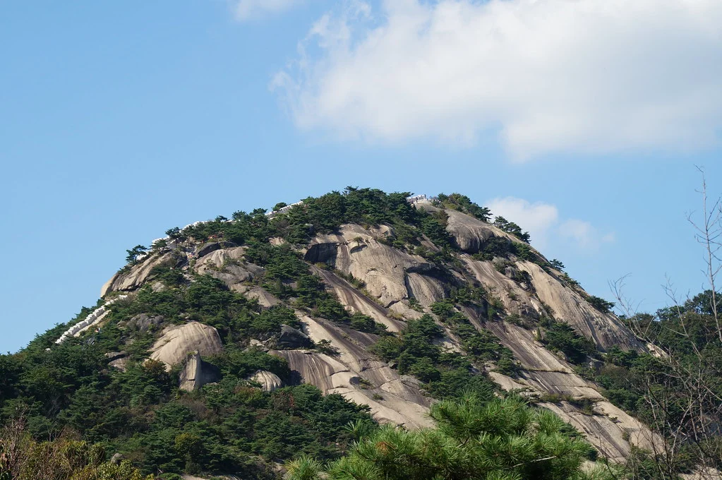
Inwangsan’s rock is a major part of its identity. Large, smooth-looking surfaces rise between pines, and the ridge repeatedly switches between built stairs and the mountain’s own uneven ground. What appears softly rounded from downtown becomes a much more textured climb at close range. Move at a pace that lets you place your feet deliberately. The upper sections reward comfortable shoes with grip and a small backpack that leaves your hands free for rails. Carry water before entering the trail; a café on the lower slopes is not a source of supplies along the summit ridge. Check signs at junctions rather than treating every visible rocky outcrop as part of your route. The Inwangsan Gokseong, a projecting defensive section of the wall, remains a restricted military area according to the city’s guide. Follow the public trail around signed boundaries. For a clear panorama, visibility matters more than checking a summit off a list. Choose a dry day with a reasonable view forecast, and allow the descent enough daylight. Wet rock, ice, or dense fog can turn an otherwise manageable outing into a much harder one. In poor conditions, the foothills and nearby indoor stops make a better use of the day.
Descend Toward a Neighborhood, a Book, or a Long Lunch
Gaël Chardon · Original · CC BY-SA 2.0 ·
Returning toward Sajik Park makes Seochon a convenient next stop. A signed route toward Suseongdong Valley can also lead into the neighborhood, but it is a specific descent, not the destination of every path heading downhill. Save the route before leaving the ridge and keep the whole group on the same plan. For a quieter pause, investigate Inwangsan Forest Shelter, a public reading and resting space among the trees. Seoul’s June 2026 report describes access from several foothill directions, including Suseongdong and the Chosochaekbang area. It works best as a deliberate stop on a suitable route, rather than something you assume you will pass after every summit hike. Chosochaekbang is a different place: a book café in a former guard-post building, with seating and views toward the city. Choose it for coffee and browsing, and the forest shelter for a reading break in a public space. Neither removes the need to plan the walking approach. The city’s forest-shelter guide is useful for understanding their relationship to the trails. A northern finish near Changuimun puts Buam-dong within reach and gives you bus connections back toward Gyeongbokgung. A western finish in Muak-dong instead fits Dongnimmun and the Seodaemun area. That flexibility is one of Inwangsan’s strengths: the hike can connect two parts of the city rather than interrupt the rest of your trip.
Can You Hike Inwangsan on Any Day?
As checked on October 12, 2026, Visit Seoul’s current listing describes daily, 24-hour opening, consistent with the city-wall guide. Older blanket Monday-closure rules are not the current published routine. Follow any temporary closure or access restriction posted for your actual visit. For a first hike, use daylight to learn the route. Sunrise and sunset plans also involve walking in darkness, so they require a light, familiarity with the descent, and more preparation than an afternoon viewpoint stop. A daytime climb still delivers the mountain’s central reward: a wall, a rocky ridge, and an expansive city view in the same walk. Use a restroom before the mountain section and take the water and snack you will need. Keep the post-hike meal flexible rather than booking it against an optimistic climbing time. Inwangsan is at its best when there is room to pause on the way up and enjoy the neighborhood on the way down.