Bugaksan and the Seoul City Wall: A Ridge Walk Above the Old Capital
KOREA.NET - Official page of the Republic of Korea · Original · CC BY-SA 2.0 ·
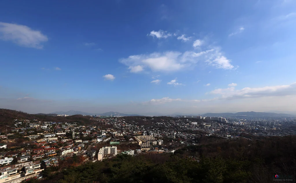
From central Seoul, the mountains can look like a backdrop. On Bugaksan, they become the organizing shape of the city. Neighborhoods fill the folds below the ridge, palace grounds occupy the flatter land, and the old city wall climbs the slopes between them. Walking here makes the geography of historic Seoul much easier to understand. The most rewarding outing links a gate, a climb, several viewpoints, and a descent into another neighborhood. There is history underfoot throughout, from the wall’s changing masonry to a pine tree associated with the 1968 attack on the Blue House. It is a good half-day choice for travelers who want an active break from museums without leaving the central districts behind. Watch the names when planning: Bugaksan, also spelled Bukaksan, is the mountain immediately north of the old city center. Baegak is another name used on official wall maps. Bukhansan is a different, much larger mountain area farther north. A search that sends you to Bukhansan Ui Station is taking you to the wrong starting point for this walk.
Pick Your Finish Before You Start
KOREA.NET - Official page of the Republic of Korea · Original · CC BY-SA 2.0 ·
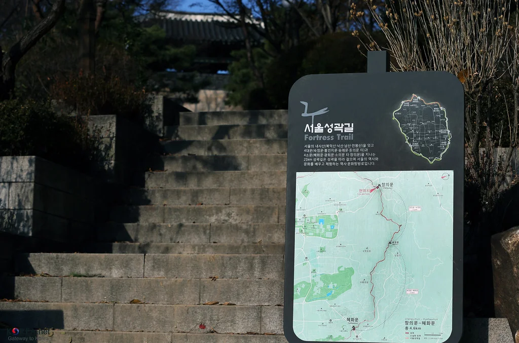
A straightforward west-to-east plan is Changuimun Gate → Baegakmaru → Cheongundae → Sukjeongmun Gate → Malbawi → Waryong Park. Continue toward Hyehwamun if you want the full Baegak section, or choose a signed descent toward Samcheong Park for an afternoon in Samcheong-dong. Save the intended exit along with the summit on your map. The official Changuimun–Hyehwamun section measures 4.7 kilometers and takes about three hours. That includes the neighborhood stretch beyond Waryong Park, not just the ridge between the two mountain gates. Add time for the approach, rests, and views. The Seoul City Wall route map is more useful than a single search pin labeled “Bugaksan.” For Changuimun, the city lists buses 1020, 7022, and 7212 from near Gyeongbokgung Station, Exit 3, to the Jahamun Pass/Yun Dong-ju’s Hill stop. Taking the bus preserves your energy for the steep wall-side stairs rather than spending it on the uphill streets below. Starting from Waryong Park reverses the experience: you reach the ridge from the east and finish by descending toward Changuimun and Buam-dong. It reduces the long stair climb at the western end, but replaces it with a substantial stair descent. Choose the direction for your knees as well as for where you would like to eat afterward.
Changuimun: Pause at the Gate Before the Climb
KOREA.NET - Official page of the Republic of Korea · Original · CC BY-SA 2.0 ·
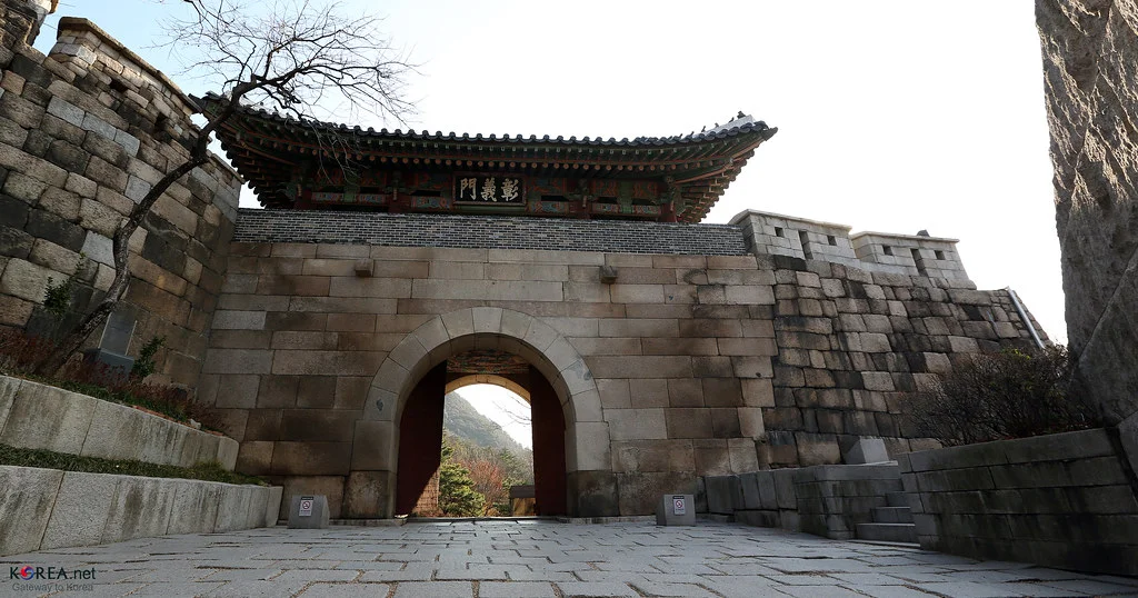
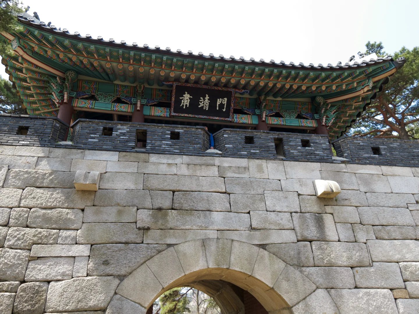
Changuimun sits at the saddle between Bugaksan and Inwangsan. Its other name, Jahamun, helps connect the gate to the bus-stop names nearby. The rounded stone arch and timber pavilion make a strong starting point: you can see how a passage through the city wall was fitted into a natural gap between mountains. Look closely before heading up. The stone surfaces around the passage have a different character from the crisp painted brackets under the roof. The Korea Heritage Agency also points out the carved drainage details, shaped like lotus leaves, on the exterior of the pavilion. Small features like these give the gate more interest than a quick photograph from across the approach. The wall beyond follows the terrain rather than imposing a level line across it. As you climb, notice the change in stone sizes and the way each stretch meets the slope. A walk through the whole landscape is a particularly satisfying way to experience fortifications: their position begins to explain their purpose. Changuimun also works as a short visit for someone who cannot take on the ridge. The neighboring Buam-dong and Yun Dong-ju Literature Museum area can give that outing a different focus. Keep museum opening arrangements separate from access to the outdoor wall route.
The Stair Climb, the Summit, and the Story Along the Ridge
KOREA.NET - Official page of the Republic of Korea · Original · CC BY-SA 2.0 ·
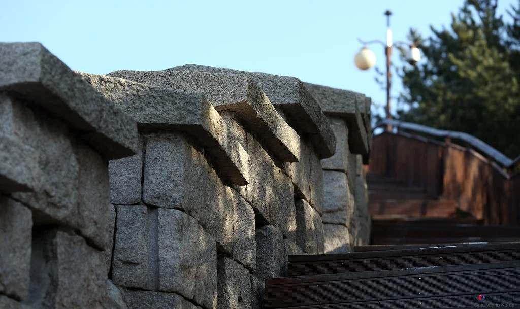
The stairs from Changuimun toward Baegakmaru are the section that catches many visitors by surprise. The mountain is close to downtown, but the ascent is sustained. Set a steady pace and use the wider resting places to stop; frequent short pauses leave more attention for the scenery than a sprint to the top. Baegakmaru is marked by a summit stone. From the high points, the reward is the relationship between the forested slopes and the city below. Cheongundae provides another outlook, so there is little reason to crowd one narrow spot trying to capture the entire day in a single photograph. On hazier days, the wall, pines, and nearby ridges still supply plenty to notice. Between Baegakmaru and Cheongundae, an interpretive stop explains a pine tree scarred during the January 21, 1968 incident, when North Korean commandos attempted to attack the Blue House. It helps explain the mountain’s long period of restricted access. Read it as part of the landscape’s recent history, alongside the much older defensive wall. Carry your water and a snack from the start. There are no dependable shopping stops on the ridge, and the stairs can feel exposed to sun and wind. Shoes with grip are useful on both stone and wood; after rain or in icy weather, the descent calls for particular care. Keep enough time to walk down at a comfortable pace.
Sukjeongmun and the Choice of Neighborhoods Below
Tom Page · Original · CC BY-SA 2.0 ·
Sukjeongmun is the city wall’s main northern gate. Pines frame its pavilion, while the wall continues along both sides into the mountain setting. Reaching it gives the ridge walk a clear second landmark, quite different from Changuimun’s position by a road and neighborhood streets. The approach offers several ways to appreciate the structure: near the arch, the mass of the stonework dominates; farther back, the roof and surrounding trees settle into a single composition. Stay on the walking route and let people through the gateway while you look around. Beyond Sukjeongmun, pay attention around Malbawi and the viewpoint junctions. A descent to Samcheong Park takes you toward Samcheong-dong’s cafés and galleries. Waryong Park keeps you on course for the full walk toward Hyehwamun. These are different finishes, so following the next group of walkers is a poor substitute for checking a sign. After Waryong Park, the character of the wall route changes. Neighborhood lanes and school boundaries replace the continuous mountain-edge view; some surviving wall sections appear among later buildings. Follow the official route markers through this stretch. It is an interesting ending if you enjoy seeing how an old city survives inside a newer one, rather than only where it has been preserved as a monument.
Current Access, Old Guidebooks, and a Practical Day Plan
As checked on October 12, 2026, the official wall guide lists year-round, 24-hour self-directed access. A March 2026 Presidential Security Service notice also confirms that 24-hour opening is being maintained. Older accounts of mandatory visitor passes and fixed entrance closing times should not be used as the current routine. For a first visit, walk in daylight. The city separately recommends seasonal visiting windows: 7 a.m.–6 p.m. in spring and fall, 7 a.m.–7 p.m. in summer, and 9 a.m.–5 p.m. in winter. These are recommended hours, not a replacement admission schedule. Current on-site restrictions still determine which paths are available. A practical plan is a morning bus to Changuimun, a measured ridge crossing, and lunch in the neighborhood where you descend. If equipment or route advice is needed, the Seoul Hiking Tourism Center has a Bugaksan branch in Samcheong-dong. Its location suits an eastern approach better than a last-minute stop at Changuimun; arrange rental returns around your chosen direction. Keep a visit inside the Blue House grounds separate from this hike. The city-wall route has its own entrances and movement through the mountain. With the exit settled and the morning kept free, you can enjoy the walk as a continuous journey across Seoul’s northern horizon.